You are here: Home > Network List > US - United States National Seismic Network Stations List
> Station HAWA Hanford, Washington, USA > Earthquake Result Viewer
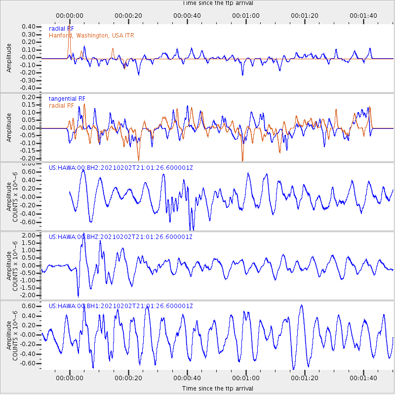
HAWA Hanford, Washington, USA - Earthquake Result Viewer
*The percent match for this event was below the threshold and hence no stack was calculated.
| Earthquake location: |
Fiji Islands |
| Earthquake latitude/longitude: |
-16.2/177.9 |
| Earthquake time(UTC): |
2021/02/02 (033) 20:49:28 GMT |
| Earthquake Depth: |
10 km |
| Earthquake Magnitude: |
5.8 Mww |
| Earthquake Catalog/Contributor: |
NEIC PDE/us |
|
| Network: |
US United States National Seismic Network |
| Station: |
HAWA Hanford, Washington, USA |
| Lat/Lon: |
46.39 N/119.53 W |
| Elevation: |
364 m |
|
| Distance: |
83.9 deg |
| Az: |
38.144 deg |
| Baz: |
238.999 deg |
| Ray Param: |
$rayparam |
*The percent match for this event was below the threshold and hence was not used in the summary stack. |
|
| Radial Match: |
50.866154 % |
| Radial Bump: |
400 |
| Transverse Match: |
56.207767 % |
| Transverse Bump: |
400 |
| SOD ConfigId: |
23341671 |
| Insert Time: |
2021-02-16 22:09:32.825 +0000 |
| GWidth: |
2.5 |
| Max Bumps: |
400 |
| Tol: |
0.001 |
|
Signal To Noise
| Channel | StoN | STA | LTA |
| US:HAWA:00:BHZ:20210202T21:01:26.600001Z | 2.7846818 | 9.781724E-7 | 3.51269E-7 |
| US:HAWA:00:BH1:20210202T21:01:26.600001Z | 0.95679873 | 2.2942992E-7 | 2.397891E-7 |
| US:HAWA:00:BH2:20210202T21:01:26.600001Z | 1.3734188 | 3.6116842E-7 | 2.6297033E-7 |
| Arrivals |
| Ps | |
| PpPs | |
| PsPs/PpSs | |


