You are here: Home > Network List > US - United States National Seismic Network Stations List
> Station AMTX Amarillo, Texas, USA > Earthquake Result Viewer
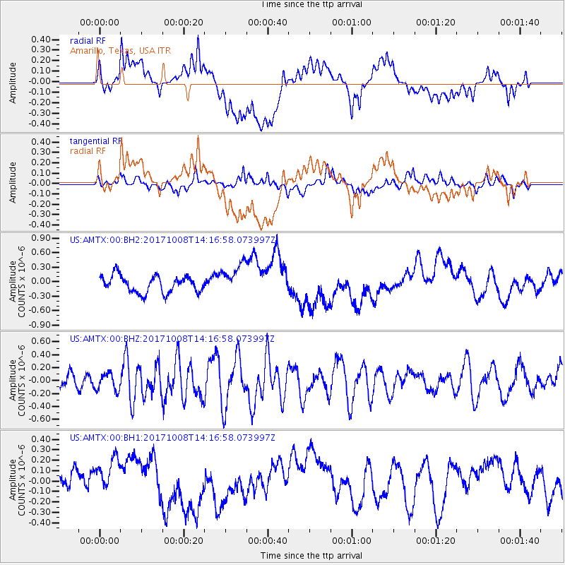
AMTX Amarillo, Texas, USA - Earthquake Result Viewer
*The percent match for this event was below the threshold and hence no stack was calculated.
| Earthquake location: |
Tonga Islands |
| Earthquake latitude/longitude: |
-19.0/-175.6 |
| Earthquake time(UTC): |
2017/10/08 (281) 14:04:38 GMT |
| Earthquake Depth: |
10 km |
| Earthquake Magnitude: |
6.1 Mww |
| Earthquake Catalog/Contributor: |
NEIC PDE/us |
|
| Network: |
US United States National Seismic Network |
| Station: |
AMTX Amarillo, Texas, USA |
| Lat/Lon: |
34.53 N/101.41 W |
| Elevation: |
1010 m |
|
| Distance: |
88.2 deg |
| Az: |
52.615 deg |
| Baz: |
245.583 deg |
| Ray Param: |
$rayparam |
*The percent match for this event was below the threshold and hence was not used in the summary stack. |
|
| Radial Match: |
36.800484 % |
| Radial Bump: |
400 |
| Transverse Match: |
49.772263 % |
| Transverse Bump: |
400 |
| SOD ConfigId: |
2364251 |
| Insert Time: |
2017-10-22 14:15:55.519 +0000 |
| GWidth: |
2.5 |
| Max Bumps: |
400 |
| Tol: |
0.001 |
|
Signal To Noise
| Channel | StoN | STA | LTA |
| US:AMTX:00:BHZ:20171008T14:16:58.073997Z | 1.0619137 | 1.3179898E-7 | 1.2411458E-7 |
| US:AMTX:00:BH1:20171008T14:16:58.073997Z | 2.030377 | 1.8903991E-7 | 9.310582E-8 |
| US:AMTX:00:BH2:20171008T14:16:58.073997Z | 1.9370449 | 3.36321E-7 | 1.7362582E-7 |
| Arrivals |
| Ps | |
| PpPs | |
| PsPs/PpSs | |


