You are here: Home > Network List > UU - University of Utah Regional Network Stations List
> Station CCUT Cedar City, UT, USA > Earthquake Result Viewer
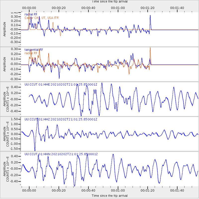
CCUT Cedar City, UT, USA - Earthquake Result Viewer
*The percent match for this event was below the threshold and hence no stack was calculated.
| Earthquake location: |
Fiji Islands |
| Earthquake latitude/longitude: |
-16.2/177.9 |
| Earthquake time(UTC): |
2021/02/02 (033) 20:49:28 GMT |
| Earthquake Depth: |
10 km |
| Earthquake Magnitude: |
5.8 Mww |
| Earthquake Catalog/Contributor: |
NEIC PDE/us |
|
| Network: |
UU University of Utah Regional Network |
| Station: |
CCUT Cedar City, UT, USA |
| Lat/Lon: |
37.55 N/113.36 W |
| Elevation: |
2127 m |
|
| Distance: |
83.8 deg |
| Az: |
48.154 deg |
| Baz: |
244.2 deg |
| Ray Param: |
$rayparam |
*The percent match for this event was below the threshold and hence was not used in the summary stack. |
|
| Radial Match: |
67.56869 % |
| Radial Bump: |
375 |
| Transverse Match: |
62.512707 % |
| Transverse Bump: |
400 |
| SOD ConfigId: |
23341671 |
| Insert Time: |
2021-02-16 22:10:00.414 +0000 |
| GWidth: |
2.5 |
| Max Bumps: |
400 |
| Tol: |
0.001 |
|
Signal To Noise
| Channel | StoN | STA | LTA |
| UU:CCUT:01:HHZ:20210202T21:01:25.850001Z | 3.0035095 | 6.004513E-7 | 1.9991656E-7 |
| UU:CCUT:01:HHN:20210202T21:01:25.850001Z | 0.6767293 | 1.1189363E-7 | 1.6534473E-7 |
| UU:CCUT:01:HHE:20210202T21:01:25.850001Z | 2.3453097 | 3.0783465E-7 | 1.3125545E-7 |
| Arrivals |
| Ps | |
| PpPs | |
| PsPs/PpSs | |


