You are here: Home > Network List > GE - GEOFON Stations List
> Station UGM GEOFON Station Wanagama, Indonesia > Earthquake Result Viewer
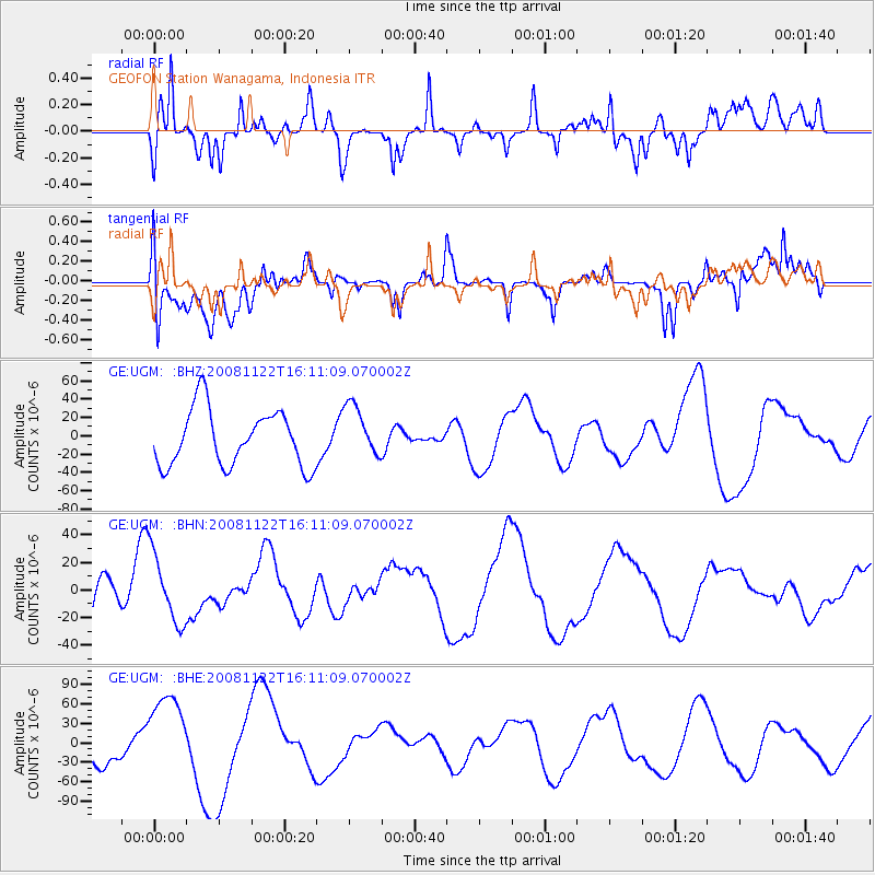
UGM GEOFON Station Wanagama, Indonesia - Earthquake Result Viewer
*The percent match for this event was below the threshold and hence no stack was calculated.
| Earthquake location: |
Southeast Of Loyalty Islands |
| Earthquake latitude/longitude: |
-22.5/171.2 |
| Earthquake time(UTC): |
2008/11/22 (327) 16:01:39 GMT |
| Earthquake Depth: |
57 km |
| Earthquake Magnitude: |
5.7 MB, 6.4 MW, 6.4 MW |
| Earthquake Catalog/Contributor: |
WHDF/NEIC |
|
| Network: |
GE GEOFON |
| Station: |
UGM GEOFON Station Wanagama, Indonesia |
| Lat/Lon: |
7.91 S/110.52 E |
| Elevation: |
350 m |
|
| Distance: |
60.0 deg |
| Az: |
273.863 deg |
| Baz: |
111.365 deg |
| Ray Param: |
$rayparam |
*The percent match for this event was below the threshold and hence was not used in the summary stack. |
|
| Radial Match: |
51.960747 % |
| Radial Bump: |
400 |
| Transverse Match: |
42.151054 % |
| Transverse Bump: |
400 |
| SOD ConfigId: |
2658 |
| Insert Time: |
2010-03-09 05:10:49.382 +0000 |
| GWidth: |
2.5 |
| Max Bumps: |
400 |
| Tol: |
0.001 |
|
Signal To Noise
| Channel | StoN | STA | LTA |
| GE:UGM: :BHN:20081122T16:11:09.070002Z | 1.2533487 | 2.4598106E-5 | 1.9625908E-5 |
| GE:UGM: :BHE:20081122T16:11:09.070002Z | 2.5363784 | 6.483379E-5 | 2.556156E-5 |
| GE:UGM: :BHZ:20081122T16:11:09.070002Z | 0.9493319 | 2.9136158E-5 | 3.0691222E-5 |
| Arrivals |
| Ps | |
| PpPs | |
| PsPs/PpSs | |


