You are here: Home > Network List > GE - GEOFON Stations List
> Station UGM GEOFON Station Wanagama, Indonesia > Earthquake Result Viewer
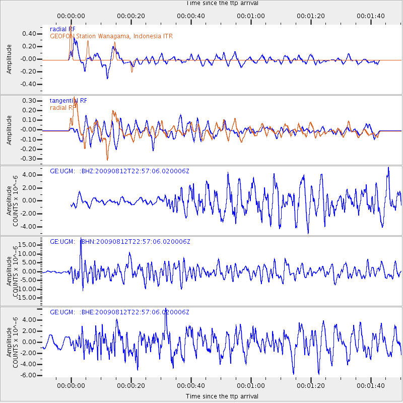
UGM GEOFON Station Wanagama, Indonesia - Earthquake Result Viewer
*The percent match for this event was below the threshold and hence no stack was calculated.
| Earthquake location: |
Southeast Of Honshu, Japan |
| Earthquake latitude/longitude: |
32.8/140.4 |
| Earthquake time(UTC): |
2009/08/12 (224) 22:48:51 GMT |
| Earthquake Depth: |
53 km |
| Earthquake Magnitude: |
6.2 MB, 6.6 MW, 6.6 MW |
| Earthquake Catalog/Contributor: |
WHDF/NEIC |
|
| Network: |
GE GEOFON |
| Station: |
UGM GEOFON Station Wanagama, Indonesia |
| Lat/Lon: |
7.91 S/110.52 E |
| Elevation: |
350 m |
|
| Distance: |
49.5 deg |
| Az: |
220.458 deg |
| Baz: |
33.474 deg |
| Ray Param: |
$rayparam |
*The percent match for this event was below the threshold and hence was not used in the summary stack. |
|
| Radial Match: |
79.779 % |
| Radial Bump: |
400 |
| Transverse Match: |
77.14461 % |
| Transverse Bump: |
400 |
| SOD ConfigId: |
2622 |
| Insert Time: |
2010-03-09 05:10:51.604 +0000 |
| GWidth: |
2.5 |
| Max Bumps: |
400 |
| Tol: |
0.001 |
|
Signal To Noise
| Channel | StoN | STA | LTA |
| GE:UGM: :BHN:20090812T22:57:06.020006Z | 13.106896 | 5.8855226E-6 | 4.4904013E-7 |
| GE:UGM: :BHE:20090812T22:57:06.020006Z | 2.0690582 | 1.141834E-6 | 5.518617E-7 |
| GE:UGM: :BHZ:20090812T22:57:06.020006Z | 1.4639262 | 6.6166905E-7 | 4.519825E-7 |
| Arrivals |
| Ps | |
| PpPs | |
| PsPs/PpSs | |


