You are here: Home > Network List > UW - Pacific Northwest Regional Seismic Network Stations List
> Station HOOD Mt Hood Meadows, OR CREST BB SMO > Earthquake Result Viewer
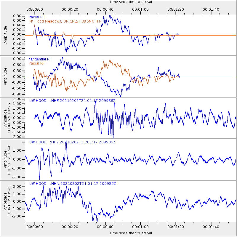
HOOD Mt Hood Meadows, OR CREST BB SMO - Earthquake Result Viewer
*The percent match for this event was below the threshold and hence no stack was calculated.
| Earthquake location: |
Fiji Islands |
| Earthquake latitude/longitude: |
-16.2/177.9 |
| Earthquake time(UTC): |
2021/02/02 (033) 20:49:28 GMT |
| Earthquake Depth: |
10 km |
| Earthquake Magnitude: |
5.8 Mww |
| Earthquake Catalog/Contributor: |
NEIC PDE/us |
|
| Network: |
UW Pacific Northwest Regional Seismic Network |
| Station: |
HOOD Mt Hood Meadows, OR CREST BB SMO |
| Lat/Lon: |
45.32 N/121.65 W |
| Elevation: |
1520 m |
|
| Distance: |
82.1 deg |
| Az: |
38.276 deg |
| Baz: |
237.498 deg |
| Ray Param: |
$rayparam |
*The percent match for this event was below the threshold and hence was not used in the summary stack. |
|
| Radial Match: |
55.28214 % |
| Radial Bump: |
400 |
| Transverse Match: |
57.732685 % |
| Transverse Bump: |
400 |
| SOD ConfigId: |
23341671 |
| Insert Time: |
2021-02-16 22:11:04.028 +0000 |
| GWidth: |
2.5 |
| Max Bumps: |
400 |
| Tol: |
0.001 |
|
Signal To Noise
| Channel | StoN | STA | LTA |
| UW:HOOD: :HHZ:20210202T21:01:17.209986Z | 2.3911066 | 8.837898E-7 | 3.696154E-7 |
| UW:HOOD: :HHN:20210202T21:01:17.209986Z | 1.399768 | 9.3063824E-7 | 6.648518E-7 |
| UW:HOOD: :HHE:20210202T21:01:17.209986Z | 1.7232727 | 8.6986853E-7 | 5.0477706E-7 |
| Arrivals |
| Ps | |
| PpPs | |
| PsPs/PpSs | |


