You are here: Home > Network List > UW - Pacific Northwest Regional Seismic Network Stations List
> Station IRON Crane, OR, USA > Earthquake Result Viewer
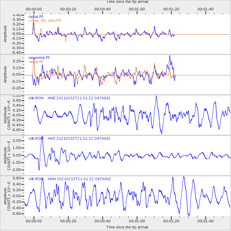
IRON Crane, OR, USA - Earthquake Result Viewer
*The percent match for this event was below the threshold and hence no stack was calculated.
| Earthquake location: |
Fiji Islands |
| Earthquake latitude/longitude: |
-16.2/177.9 |
| Earthquake time(UTC): |
2021/02/02 (033) 20:49:28 GMT |
| Earthquake Depth: |
10 km |
| Earthquake Magnitude: |
5.8 Mww |
| Earthquake Catalog/Contributor: |
NEIC PDE/us |
|
| Network: |
UW Pacific Northwest Regional Seismic Network |
| Station: |
IRON Crane, OR, USA |
| Lat/Lon: |
43.36 N/118.47 W |
| Elevation: |
1226 m |
|
| Distance: |
83.0 deg |
| Az: |
41.16 deg |
| Baz: |
240.086 deg |
| Ray Param: |
$rayparam |
*The percent match for this event was below the threshold and hence was not used in the summary stack. |
|
| Radial Match: |
60.97883 % |
| Radial Bump: |
366 |
| Transverse Match: |
73.69054 % |
| Transverse Bump: |
400 |
| SOD ConfigId: |
23341671 |
| Insert Time: |
2021-02-16 22:11:06.853 +0000 |
| GWidth: |
2.5 |
| Max Bumps: |
400 |
| Tol: |
0.001 |
|
Signal To Noise
| Channel | StoN | STA | LTA |
| UW:IRON: :HHZ:20210202T21:01:22.047999Z | 6.207965 | 1.0263171E-6 | 1.6532263E-7 |
| UW:IRON: :HHN:20210202T21:01:22.047999Z | 1.5669845 | 3.068432E-7 | 1.958176E-7 |
| UW:IRON: :HHE:20210202T21:01:22.047999Z | 1.5145401 | 2.4009557E-7 | 1.5852706E-7 |
| Arrivals |
| Ps | |
| PpPs | |
| PsPs/PpSs | |


