You are here: Home > Network List > GE - GEOFON Stations List
> Station UGM GEOFON Station Wanagama, Indonesia > Earthquake Result Viewer
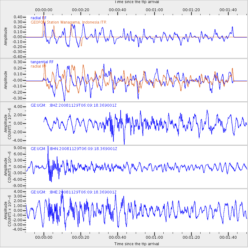
UGM GEOFON Station Wanagama, Indonesia - Earthquake Result Viewer
*The percent match for this event was below the threshold and hence no stack was calculated.
| Earthquake location: |
Fiji Islands Region |
| Earthquake latitude/longitude: |
-18.7/-177.7 |
| Earthquake time(UTC): |
2008/11/29 (334) 05:59:16 GMT |
| Earthquake Depth: |
386 km |
| Earthquake Magnitude: |
5.7 MB, 6.0 MW, 5.9 MW |
| Earthquake Catalog/Contributor: |
WHDF/NEIC |
|
| Network: |
GE GEOFON |
| Station: |
UGM GEOFON Station Wanagama, Indonesia |
| Lat/Lon: |
7.91 S/110.52 E |
| Elevation: |
350 m |
|
| Distance: |
70.3 deg |
| Az: |
268.124 deg |
| Baz: |
106.995 deg |
| Ray Param: |
$rayparam |
*The percent match for this event was below the threshold and hence was not used in the summary stack. |
|
| Radial Match: |
44.639385 % |
| Radial Bump: |
400 |
| Transverse Match: |
57.46895 % |
| Transverse Bump: |
400 |
| SOD ConfigId: |
2658 |
| Insert Time: |
2010-03-09 05:11:10.909 +0000 |
| GWidth: |
2.5 |
| Max Bumps: |
400 |
| Tol: |
0.001 |
|
Signal To Noise
| Channel | StoN | STA | LTA |
| GE:UGM: :BHN:20081129T06:09:18.369001Z | 2.642287 | 3.0567992E-6 | 1.1568764E-6 |
| GE:UGM: :BHE:20081129T06:09:18.369001Z | 1.6367297 | 1.748119E-6 | 1.0680559E-6 |
| GE:UGM: :BHZ:20081129T06:09:18.369001Z | 0.79405344 | 7.8995276E-7 | 9.948358E-7 |
| Arrivals |
| Ps | |
| PpPs | |
| PsPs/PpSs | |


