You are here: Home > Network List > CI - Caltech Regional Seismic Network Stations List
> Station MPM Manuel Prospect Mine, California, USA > Earthquake Result Viewer
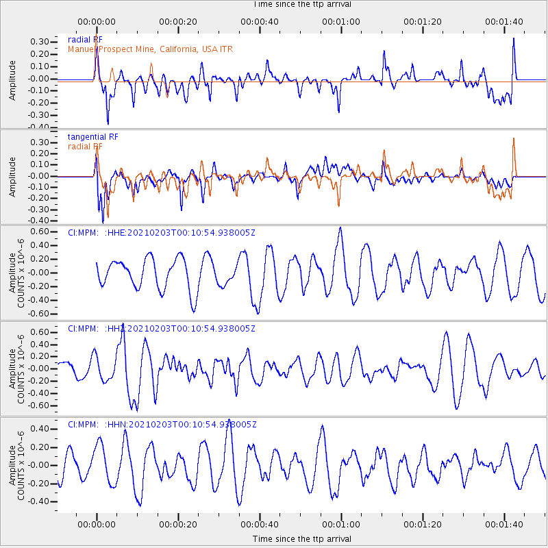
MPM Manuel Prospect Mine, California, USA - Earthquake Result Viewer
*The percent match for this event was below the threshold and hence no stack was calculated.
| Earthquake location: |
Southeast Of Loyalty Islands |
| Earthquake latitude/longitude: |
-22.6/172.1 |
| Earthquake time(UTC): |
2021/02/02 (033) 23:58:34 GMT |
| Earthquake Depth: |
10 km |
| Earthquake Magnitude: |
5.7 mww |
| Earthquake Catalog/Contributor: |
NEIC PDE/us |
|
| Network: |
CI Caltech Regional Seismic Network |
| Station: |
MPM Manuel Prospect Mine, California, USA |
| Lat/Lon: |
36.06 N/117.49 W |
| Elevation: |
185 m |
|
| Distance: |
88.4 deg |
| Az: |
49.79 deg |
| Baz: |
240.597 deg |
| Ray Param: |
$rayparam |
*The percent match for this event was below the threshold and hence was not used in the summary stack. |
|
| Radial Match: |
61.42889 % |
| Radial Bump: |
400 |
| Transverse Match: |
68.79012 % |
| Transverse Bump: |
400 |
| SOD ConfigId: |
23341671 |
| Insert Time: |
2021-02-17 01:04:41.317 +0000 |
| GWidth: |
2.5 |
| Max Bumps: |
400 |
| Tol: |
0.001 |
|
Signal To Noise
| Channel | StoN | STA | LTA |
| CI:MPM: :HHZ:20210203T00:10:54.938005Z | 1.4697044 | 1.9567362E-7 | 1.3313809E-7 |
| CI:MPM: :HHN:20210203T00:10:54.938005Z | 1.7589191 | 2.2540499E-7 | 1.2814972E-7 |
| CI:MPM: :HHE:20210203T00:10:54.938005Z | 0.6082763 | 1.3584864E-7 | 2.2333377E-7 |
| Arrivals |
| Ps | |
| PpPs | |
| PsPs/PpSs | |


