You are here: Home > Network List > GE - GEOFON Stations List
> Station UGM GEOFON Station Wanagama, Indonesia > Earthquake Result Viewer
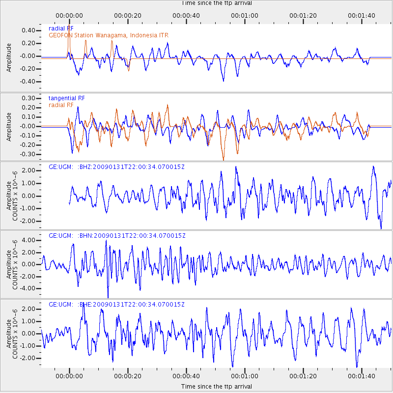
UGM GEOFON Station Wanagama, Indonesia - Earthquake Result Viewer
*The percent match for this event was below the threshold and hence no stack was calculated.
| Earthquake location: |
Near East Coast Of Honshu, Japan |
| Earthquake latitude/longitude: |
36.7/141.1 |
| Earthquake time(UTC): |
2009/01/31 (031) 21:51:52 GMT |
| Earthquake Depth: |
34 km |
| Earthquake Magnitude: |
5.6 MB, 5.3 MS, 5.8 MW, 5.7 MW |
| Earthquake Catalog/Contributor: |
WHDF/NEIC |
|
| Network: |
GE GEOFON |
| Station: |
UGM GEOFON Station Wanagama, Indonesia |
| Lat/Lon: |
7.91 S/110.52 E |
| Elevation: |
350 m |
|
| Distance: |
52.9 deg |
| Az: |
219.263 deg |
| Baz: |
30.887 deg |
| Ray Param: |
$rayparam |
*The percent match for this event was below the threshold and hence was not used in the summary stack. |
|
| Radial Match: |
60.803936 % |
| Radial Bump: |
400 |
| Transverse Match: |
63.858486 % |
| Transverse Bump: |
400 |
| SOD ConfigId: |
2658 |
| Insert Time: |
2010-03-09 05:11:38.792 +0000 |
| GWidth: |
2.5 |
| Max Bumps: |
400 |
| Tol: |
0.001 |
|
Signal To Noise
| Channel | StoN | STA | LTA |
| GE:UGM: :BHN:20090131T22:00:34.070015Z | 2.3862581 | 1.8557624E-6 | 7.7768715E-7 |
| GE:UGM: :BHE:20090131T22:00:34.070015Z | 0.9852238 | 9.816473E-7 | 9.963699E-7 |
| GE:UGM: :BHZ:20090131T22:00:34.070015Z | 1.2678013 | 6.311191E-7 | 4.9780607E-7 |
| Arrivals |
| Ps | |
| PpPs | |
| PsPs/PpSs | |


