You are here: Home > Network List > GE - GEOFON Stations List
> Station UGM GEOFON Station Wanagama, Indonesia > Earthquake Result Viewer
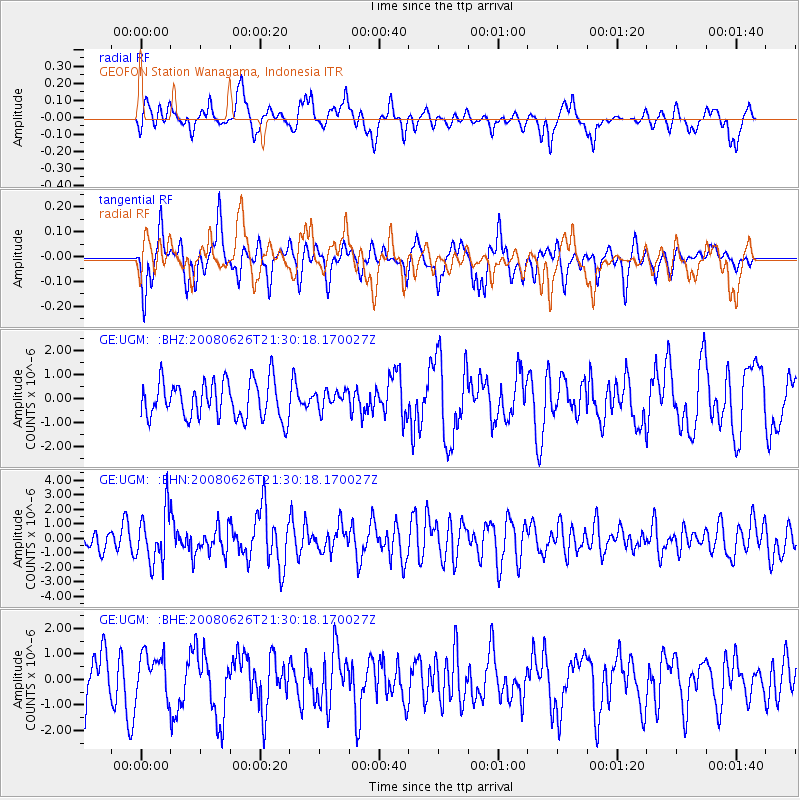
UGM GEOFON Station Wanagama, Indonesia - Earthquake Result Viewer
*The percent match for this event was below the threshold and hence no stack was calculated.
| Earthquake location: |
Tonga Islands |
| Earthquake latitude/longitude: |
-20.8/-173.3 |
| Earthquake time(UTC): |
2008/06/26 (178) 21:19:15 GMT |
| Earthquake Depth: |
38 km |
| Earthquake Magnitude: |
6.0 MB, 5.8 MS, 6.2 MW, 6.1 MW |
| Earthquake Catalog/Contributor: |
WHDF/NEIC |
|
| Network: |
GE GEOFON |
| Station: |
UGM GEOFON Station Wanagama, Indonesia |
| Lat/Lon: |
7.91 S/110.52 E |
| Elevation: |
350 m |
|
| Distance: |
74.3 deg |
| Az: |
267.363 deg |
| Baz: |
109.32 deg |
| Ray Param: |
$rayparam |
*The percent match for this event was below the threshold and hence was not used in the summary stack. |
|
| Radial Match: |
59.290962 % |
| Radial Bump: |
367 |
| Transverse Match: |
58.014984 % |
| Transverse Bump: |
371 |
| SOD ConfigId: |
2504 |
| Insert Time: |
2010-03-09 05:11:41.898 +0000 |
| GWidth: |
2.5 |
| Max Bumps: |
400 |
| Tol: |
0.001 |
|
Signal To Noise
| Channel | StoN | STA | LTA |
| GE:UGM: :BHN:20080626T21:30:18.170027Z | 2.1303208 | 1.7592688E-6 | 8.258234E-7 |
| GE:UGM: :BHE:20080626T21:30:18.170027Z | 0.98241615 | 8.7071356E-7 | 8.862981E-7 |
| GE:UGM: :BHZ:20080626T21:30:18.170027Z | 0.4804041 | 3.7768172E-7 | 7.86175E-7 |
| Arrivals |
| Ps | |
| PpPs | |
| PsPs/PpSs | |


