You are here: Home > Network List > GE - GEOFON Stations List
> Station UGM GEOFON Station Wanagama, Indonesia > Earthquake Result Viewer
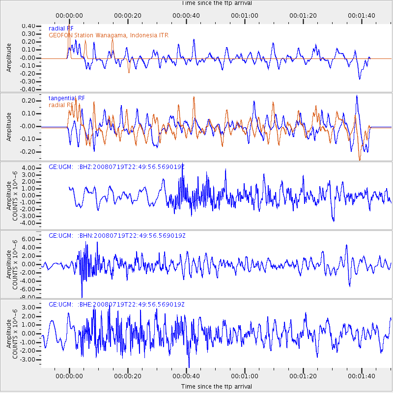
UGM GEOFON Station Wanagama, Indonesia - Earthquake Result Viewer
*The percent match for this event was below the threshold and hence no stack was calculated.
| Earthquake location: |
Fiji Islands Region |
| Earthquake latitude/longitude: |
-17.3/-177.3 |
| Earthquake time(UTC): |
2008/07/19 (201) 22:39:52 GMT |
| Earthquake Depth: |
391 km |
| Earthquake Magnitude: |
5.9 MB, 6.4 MW, 6.4 MW |
| Earthquake Catalog/Contributor: |
WHDF/NEIC |
|
| Network: |
GE GEOFON |
| Station: |
UGM GEOFON Station Wanagama, Indonesia |
| Lat/Lon: |
7.91 S/110.52 E |
| Elevation: |
350 m |
|
| Distance: |
70.7 deg |
| Az: |
267.525 deg |
| Baz: |
105.572 deg |
| Ray Param: |
$rayparam |
*The percent match for this event was below the threshold and hence was not used in the summary stack. |
|
| Radial Match: |
54.18378 % |
| Radial Bump: |
400 |
| Transverse Match: |
44.89696 % |
| Transverse Bump: |
400 |
| SOD ConfigId: |
2504 |
| Insert Time: |
2010-03-09 05:11:50.256 +0000 |
| GWidth: |
2.5 |
| Max Bumps: |
400 |
| Tol: |
0.001 |
|
Signal To Noise
| Channel | StoN | STA | LTA |
| GE:UGM: :BHN:20080719T22:49:56.569019Z | 2.3423932 | 1.9473675E-6 | 8.313581E-7 |
| GE:UGM: :BHE:20080719T22:49:56.569019Z | 1.3804975 | 1.2335464E-6 | 8.935521E-7 |
| GE:UGM: :BHZ:20080719T22:49:56.569019Z | 1.3857081 | 1.179516E-6 | 8.512009E-7 |
| Arrivals |
| Ps | |
| PpPs | |
| PsPs/PpSs | |


