You are here: Home > Network List > UW - Pacific Northwest Regional Seismic Network Stations List
> Station IRON Crane, OR, USA > Earthquake Result Viewer
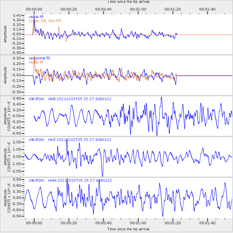
IRON Crane, OR, USA - Earthquake Result Viewer
*The percent match for this event was below the threshold and hence no stack was calculated.
| Earthquake location: |
Southeast Of Easter Island |
| Earthquake latitude/longitude: |
-36.4/-98.2 |
| Earthquake time(UTC): |
2021/02/03 (034) 05:23:41 GMT |
| Earthquake Depth: |
10 km |
| Earthquake Magnitude: |
6.9 mww |
| Earthquake Catalog/Contributor: |
NEIC PDE/us |
|
| Network: |
UW Pacific Northwest Regional Seismic Network |
| Station: |
IRON Crane, OR, USA |
| Lat/Lon: |
43.36 N/118.47 W |
| Elevation: |
1226 m |
|
| Distance: |
81.5 deg |
| Az: |
345.167 deg |
| Baz: |
163.556 deg |
| Ray Param: |
$rayparam |
*The percent match for this event was below the threshold and hence was not used in the summary stack. |
|
| Radial Match: |
48.754105 % |
| Radial Bump: |
400 |
| Transverse Match: |
64.1232 % |
| Transverse Bump: |
400 |
| SOD ConfigId: |
23341671 |
| Insert Time: |
2021-02-17 06:38:21.679 +0000 |
| GWidth: |
2.5 |
| Max Bumps: |
400 |
| Tol: |
0.001 |
|
Signal To Noise
| Channel | StoN | STA | LTA |
| UW:IRON: :HHZ:20210203T05:35:27.998012Z | 0.97725755 | 3.0024202E-7 | 3.0722916E-7 |
| UW:IRON: :HHN:20210203T05:35:27.998012Z | 1.7695855 | 3.5892995E-7 | 2.028328E-7 |
| UW:IRON: :HHE:20210203T05:35:27.998012Z | 0.894156 | 1.529617E-7 | 1.7106825E-7 |
| Arrivals |
| Ps | |
| PpPs | |
| PsPs/PpSs | |


