You are here: Home > Network List > IU - Global Seismograph Network (GSN - IRIS/USGS) Stations List
> Station CTAO Charters Towers, Australia > Earthquake Result Viewer
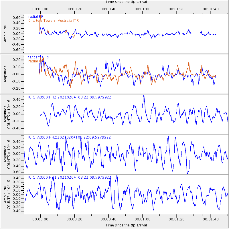
CTAO Charters Towers, Australia - Earthquake Result Viewer
*The percent match for this event was below the threshold and hence no stack was calculated.
| Earthquake location: |
Taiwan Region |
| Earthquake latitude/longitude: |
21.6/121.9 |
| Earthquake time(UTC): |
2021/02/04 (035) 08:14:03 GMT |
| Earthquake Depth: |
10 km |
| Earthquake Magnitude: |
5.4 mww |
| Earthquake Catalog/Contributor: |
NEIC PDE/us |
|
| Network: |
IU Global Seismograph Network (GSN - IRIS/USGS) |
| Station: |
CTAO Charters Towers, Australia |
| Lat/Lon: |
20.09 S/146.25 E |
| Elevation: |
367 m |
|
| Distance: |
47.8 deg |
| Az: |
148.453 deg |
| Baz: |
328.805 deg |
| Ray Param: |
$rayparam |
*The percent match for this event was below the threshold and hence was not used in the summary stack. |
|
| Radial Match: |
66.05212 % |
| Radial Bump: |
400 |
| Transverse Match: |
54.125908 % |
| Transverse Bump: |
400 |
| SOD ConfigId: |
23341671 |
| Insert Time: |
2021-02-18 09:22:35.817 +0000 |
| GWidth: |
2.5 |
| Max Bumps: |
400 |
| Tol: |
0.001 |
|
Signal To Noise
| Channel | StoN | STA | LTA |
| IU:CTAO:00:HHZ:20210204T08:22:09.597992Z | 0.8715902 | 2.0362233E-7 | 2.3362163E-7 |
| IU:CTAO:00:HH1:20210204T08:22:09.597992Z | 1.1655473 | 1.8623533E-7 | 1.5978358E-7 |
| IU:CTAO:00:HH2:20210204T08:22:09.597992Z | 0.7555201 | 1.07421684E-7 | 1.4218244E-7 |
| Arrivals |
| Ps | |
| PpPs | |
| PsPs/PpSs | |


