You are here: Home > Network List > GE - GEOFON Stations List
> Station UGM GEOFON Station Wanagama, Indonesia > Earthquake Result Viewer
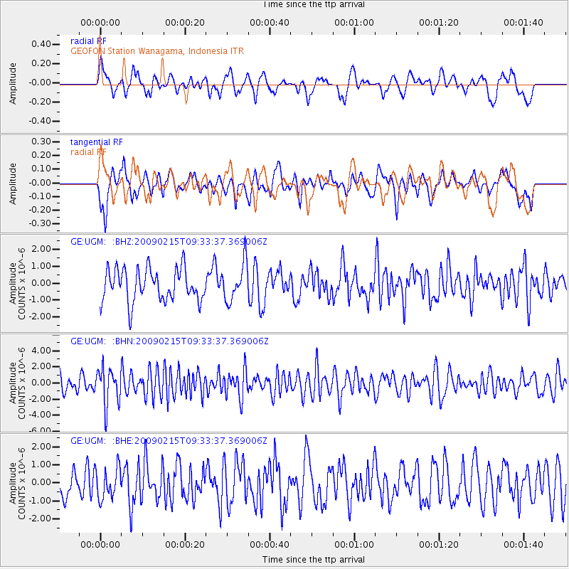
UGM GEOFON Station Wanagama, Indonesia - Earthquake Result Viewer
*The percent match for this event was below the threshold and hence no stack was calculated.
| Earthquake location: |
Near East Coast Of Honshu, Japan |
| Earthquake latitude/longitude: |
40.2/142.2 |
| Earthquake time(UTC): |
2009/02/15 (046) 09:24:31 GMT |
| Earthquake Depth: |
33 km |
| Earthquake Magnitude: |
6.1 MB, 5.5 MS, 5.7 MW, 5.7 MW |
| Earthquake Catalog/Contributor: |
WHDF/NEIC |
|
| Network: |
GE GEOFON |
| Station: |
UGM GEOFON Station Wanagama, Indonesia |
| Lat/Lon: |
7.91 S/110.52 E |
| Elevation: |
350 m |
|
| Distance: |
56.1 deg |
| Az: |
218.832 deg |
| Baz: |
28.982 deg |
| Ray Param: |
$rayparam |
*The percent match for this event was below the threshold and hence was not used in the summary stack. |
|
| Radial Match: |
57.309605 % |
| Radial Bump: |
400 |
| Transverse Match: |
54.10362 % |
| Transverse Bump: |
400 |
| SOD ConfigId: |
2658 |
| Insert Time: |
2010-03-09 05:11:59.084 +0000 |
| GWidth: |
2.5 |
| Max Bumps: |
400 |
| Tol: |
0.001 |
|
Signal To Noise
| Channel | StoN | STA | LTA |
| GE:UGM: :BHN:20090215T09:33:37.369006Z | 2.252523 | 2.3502432E-6 | 1.0433827E-6 |
| GE:UGM: :BHE:20090215T09:33:37.369006Z | 1.1110584 | 8.3338784E-7 | 7.5008467E-7 |
| GE:UGM: :BHZ:20090215T09:33:37.369006Z | 1.1999689 | 1.1514544E-6 | 9.595701E-7 |
| Arrivals |
| Ps | |
| PpPs | |
| PsPs/PpSs | |


