You are here: Home > Network List > CI - Caltech Regional Seismic Network Stations List
> Station BAR Barrett, Tecate, CA, USA > Earthquake Result Viewer
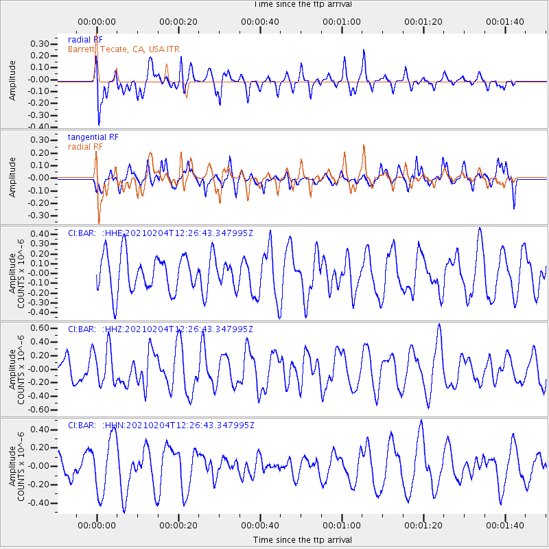
BAR Barrett, Tecate, CA, USA - Earthquake Result Viewer
*The percent match for this event was below the threshold and hence no stack was calculated.
| Earthquake location: |
Southeast Of Loyalty Islands |
| Earthquake latitude/longitude: |
-22.6/171.9 |
| Earthquake time(UTC): |
2021/02/04 (035) 12:14:26 GMT |
| Earthquake Depth: |
10 km |
| Earthquake Magnitude: |
5.7 mww |
| Earthquake Catalog/Contributor: |
NEIC PDE/us |
|
| Network: |
CI Caltech Regional Seismic Network |
| Station: |
BAR Barrett, Tecate, CA, USA |
| Lat/Lon: |
32.68 N/116.67 W |
| Elevation: |
521 m |
|
| Distance: |
87.5 deg |
| Az: |
53.128 deg |
| Baz: |
241.219 deg |
| Ray Param: |
$rayparam |
*The percent match for this event was below the threshold and hence was not used in the summary stack. |
|
| Radial Match: |
55.43038 % |
| Radial Bump: |
384 |
| Transverse Match: |
62.696457 % |
| Transverse Bump: |
400 |
| SOD ConfigId: |
23341671 |
| Insert Time: |
2021-02-18 13:20:30.370 +0000 |
| GWidth: |
2.5 |
| Max Bumps: |
400 |
| Tol: |
0.001 |
|
Signal To Noise
| Channel | StoN | STA | LTA |
| CI:BAR: :HHZ:20210204T12:26:43.347995Z | 1.2426755 | 2.746743E-7 | 2.2103463E-7 |
| CI:BAR: :HHN:20210204T12:26:43.347995Z | 2.0098674 | 3.1217465E-7 | 1.5532102E-7 |
| CI:BAR: :HHE:20210204T12:26:43.347995Z | 0.60358983 | 1.11570095E-7 | 1.8484423E-7 |
| Arrivals |
| Ps | |
| PpPs | |
| PsPs/PpSs | |


