You are here: Home > Network List > GE - GEOFON Stations List
> Station UGM GEOFON Station Wanagama, Indonesia > Earthquake Result Viewer
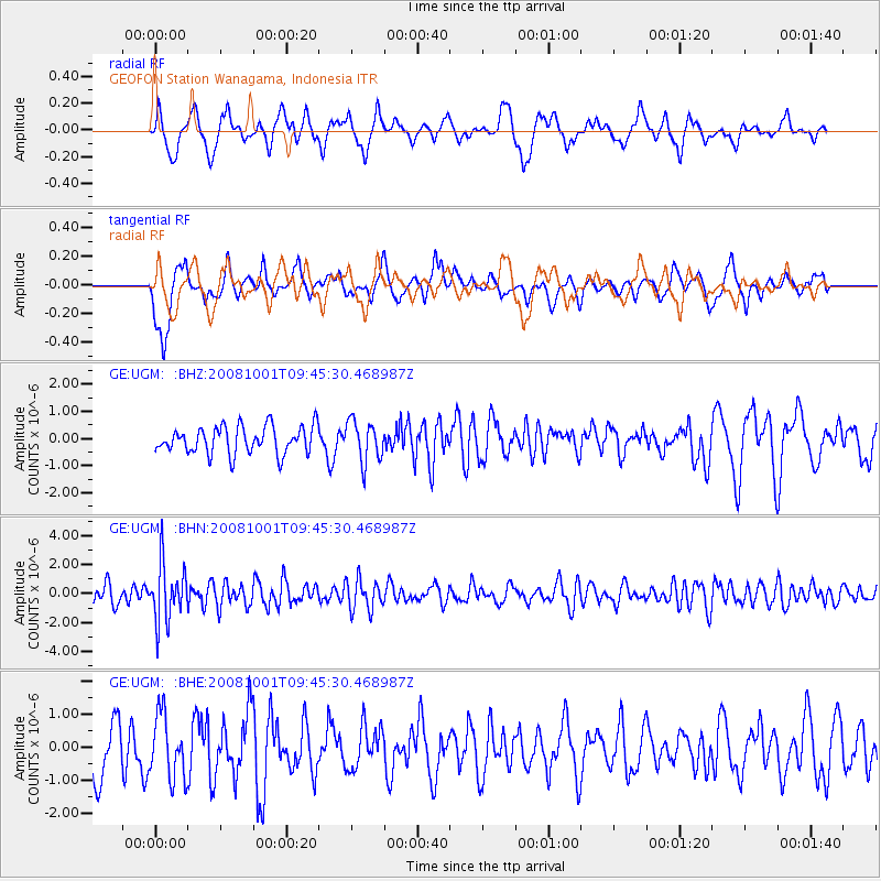
UGM GEOFON Station Wanagama, Indonesia - Earthquake Result Viewer
*The percent match for this event was below the threshold and hence no stack was calculated.
| Earthquake location: |
Southeast Of Honshu, Japan |
| Earthquake latitude/longitude: |
30.2/138.8 |
| Earthquake time(UTC): |
2008/10/01 (275) 09:38:12 GMT |
| Earthquake Depth: |
414 km |
| Earthquake Magnitude: |
5.7 MW, 5.1 MB, 5.7 MW |
| Earthquake Catalog/Contributor: |
WHDF/NEIC |
|
| Network: |
GE GEOFON |
| Station: |
UGM GEOFON Station Wanagama, Indonesia |
| Lat/Lon: |
7.91 S/110.52 E |
| Elevation: |
350 m |
|
| Distance: |
46.6 deg |
| Az: |
220.214 deg |
| Baz: |
34.364 deg |
| Ray Param: |
$rayparam |
*The percent match for this event was below the threshold and hence was not used in the summary stack. |
|
| Radial Match: |
47.894344 % |
| Radial Bump: |
400 |
| Transverse Match: |
57.756298 % |
| Transverse Bump: |
383 |
| SOD ConfigId: |
2556 |
| Insert Time: |
2010-03-09 05:12:11.943 +0000 |
| GWidth: |
2.5 |
| Max Bumps: |
400 |
| Tol: |
0.001 |
|
Signal To Noise
| Channel | StoN | STA | LTA |
| GE:UGM: :BHN:20081001T09:45:30.468987Z | 2.6798484 | 1.9781492E-6 | 7.381571E-7 |
| GE:UGM: :BHE:20081001T09:45:30.468987Z | 1.2056003 | 9.601101E-7 | 7.963752E-7 |
| GE:UGM: :BHZ:20081001T09:45:30.468987Z | 1.4956483 | 7.561159E-7 | 5.0554394E-7 |
| Arrivals |
| Ps | |
| PpPs | |
| PsPs/PpSs | |


