You are here: Home > Network List > CI - Caltech Regional Seismic Network Stations List
> Station MUR Murrieta > Earthquake Result Viewer
MUR Murrieta - Earthquake Result Viewer
*The percent match for this event was below the threshold and hence no stack was calculated.
| Earthquake location: |
Southeast Of Loyalty Islands |
| Earthquake latitude/longitude: |
-22.6/171.9 |
| Earthquake time(UTC): |
2021/02/04 (035) 12:14:26 GMT |
| Earthquake Depth: |
10 km |
| Earthquake Magnitude: |
5.7 mww |
| Earthquake Catalog/Contributor: |
NEIC PDE/us |
|
| Network: |
CI Caltech Regional Seismic Network |
| Station: |
MUR Murrieta |
| Lat/Lon: |
33.60 N/117.20 W |
| Elevation: |
562 m |
|
| Distance: |
87.6 deg |
| Az: |
52.112 deg |
| Baz: |
240.891 deg |
| Ray Param: |
$rayparam |
*The percent match for this event was below the threshold and hence was not used in the summary stack. |
|
| Radial Match: |
67.632095 % |
| Radial Bump: |
400 |
| Transverse Match: |
61.18056 % |
| Transverse Bump: |
400 |
| SOD ConfigId: |
23341671 |
| Insert Time: |
2021-02-18 13:21:04.642 +0000 |
| GWidth: |
2.5 |
| Max Bumps: |
400 |
| Tol: |
0.001 |
|
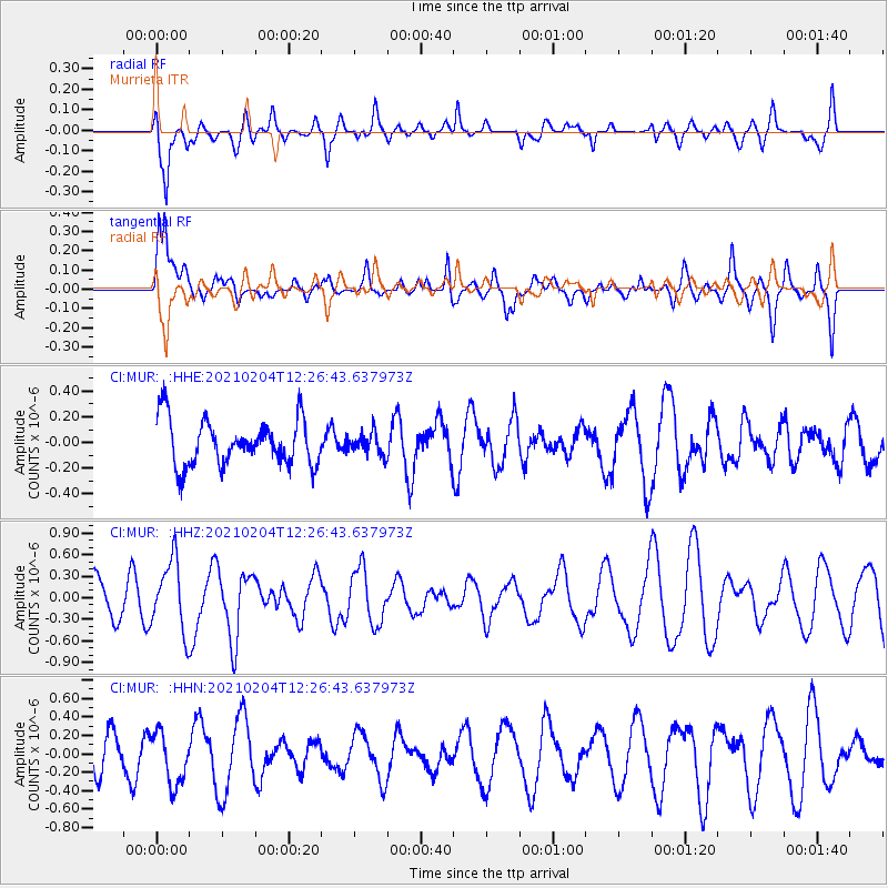
Signal To Noise
| Channel | StoN | STA | LTA |
| CI:MUR: :HHZ:20210204T12:26:43.637973Z | 1.7215536 | 4.935073E-7 | 2.8666392E-7 |
| CI:MUR: :HHN:20210204T12:26:43.637973Z | 1.4250042 | 2.8271623E-7 | 1.9839676E-7 |
| CI:MUR: :HHE:20210204T12:26:43.637973Z | 0.46882203 | 8.359828E-8 | 1.7831559E-7 |
| Arrivals |
| Ps | |
| PpPs | |
| PsPs/PpSs | |


