You are here: Home > Network List > TA - USArray Transportable Network (new EarthScope stations) Stations List
> Station L15K Ungalak Mountain, AK, USA > Earthquake Result Viewer
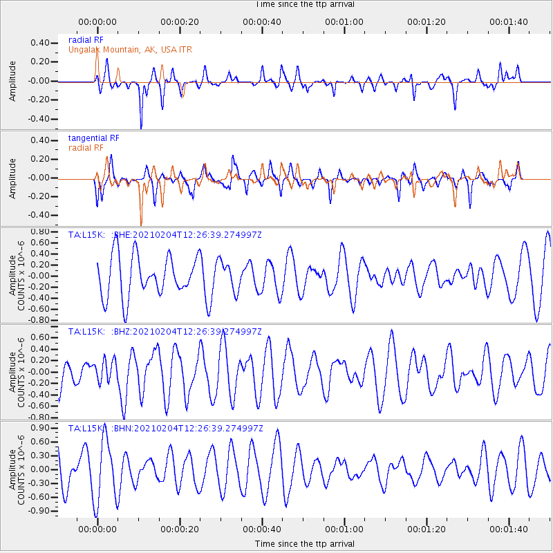
L15K Ungalak Mountain, AK, USA - Earthquake Result Viewer
*The percent match for this event was below the threshold and hence no stack was calculated.
| Earthquake location: |
Southeast Of Loyalty Islands |
| Earthquake latitude/longitude: |
-22.6/171.9 |
| Earthquake time(UTC): |
2021/02/04 (035) 12:14:26 GMT |
| Earthquake Depth: |
10 km |
| Earthquake Magnitude: |
5.7 mww |
| Earthquake Catalog/Contributor: |
NEIC PDE/us |
|
| Network: |
TA USArray Transportable Network (new EarthScope stations) |
| Station: |
L15K Ungalak Mountain, AK, USA |
| Lat/Lon: |
61.68 N/161.49 W |
| Elevation: |
219 m |
|
| Distance: |
86.7 deg |
| Az: |
12.338 deg |
| Baz: |
204.457 deg |
| Ray Param: |
$rayparam |
*The percent match for this event was below the threshold and hence was not used in the summary stack. |
|
| Radial Match: |
55.37189 % |
| Radial Bump: |
273 |
| Transverse Match: |
48.773846 % |
| Transverse Bump: |
319 |
| SOD ConfigId: |
23341671 |
| Insert Time: |
2021-02-18 13:25:16.127 +0000 |
| GWidth: |
2.5 |
| Max Bumps: |
400 |
| Tol: |
0.001 |
|
Signal To Noise
| Channel | StoN | STA | LTA |
| TA:L15K: :BHZ:20210204T12:26:39.274997Z | 0.6207117 | 1.868186E-7 | 3.0097485E-7 |
| TA:L15K: :BHN:20210204T12:26:39.274997Z | 1.8370501 | 6.9555017E-7 | 3.786234E-7 |
| TA:L15K: :BHE:20210204T12:26:39.274997Z | 0.7170674 | 2.633348E-7 | 3.6723856E-7 |
| Arrivals |
| Ps | |
| PpPs | |
| PsPs/PpSs | |


