You are here: Home > Network List > GO - National Seismic Network of Georgia Stations List
> Station TBLG Delisi, Georgia > Earthquake Result Viewer
TBLG Delisi, Georgia - Earthquake Result Viewer

| Earthquake location: |
Mindanao, Philippines |
| Earthquake latitude/longitude: |
6.8/125.2 |
| Earthquake time(UTC): |
2021/02/07 (038) 04:22:56 GMT |
| Earthquake Depth: |
16 km |
| Earthquake Magnitude: |
6.0 Mww |
| Earthquake Catalog/Contributor: |
NEIC PDE/us |
|
| Network: |
GO National Seismic Network of Georgia |
| Station: |
TBLG Delisi, Georgia |
| Lat/Lon: |
41.73 N/44.74 E |
| Elevation: |
510 m |
|
| Distance: |
78.4 deg |
| Az: |
311.103 deg |
| Baz: |
91.242 deg |
| Ray Param: |
0.049654923 |
| Estimated Moho Depth: |
19.75 km |
| Estimated Crust Vp/Vs: |
1.82 |
| Assumed Crust Vp: |
6.291 km/s |
| Estimated Crust Vs: |
3.461 km/s |
| Estimated Crust Poisson's Ratio: |
0.28 |
|
| Radial Match: |
80.90696 % |
| Radial Bump: |
400 |
| Transverse Match: |
68.981995 % |
| Transverse Bump: |
400 |
| SOD ConfigId: |
23341671 |
| Insert Time: |
2021-02-21 05:30:38.467 +0000 |
| GWidth: |
2.5 |
| Max Bumps: |
400 |
| Tol: |
0.001 |
|
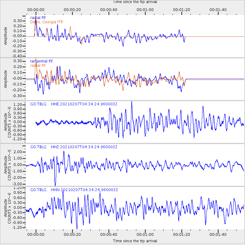
Signal To Noise
| Channel | StoN | STA | LTA |
| GO:TBLG: :HHZ:20210207T04:34:24.960003Z | 5.6044507 | 5.3238097E-7 | 9.499253E-8 |
| GO:TBLG: :HHN:20210207T04:34:24.960003Z | 2.576474 | 3.1157487E-7 | 1.2093072E-7 |
| GO:TBLG: :HHE:20210207T04:34:24.960003Z | 2.0959203 | 1.6646021E-7 | 7.9421056E-8 |
| Arrivals |
| Ps | 2.6 SECOND |
| PpPs | 8.6 SECOND |
| PsPs/PpSs | 11 SECOND |


