You are here: Home > Network List > US - United States National Seismic Network Stations List
> Station HAWA Hanford, Washington, USA > Earthquake Result Viewer
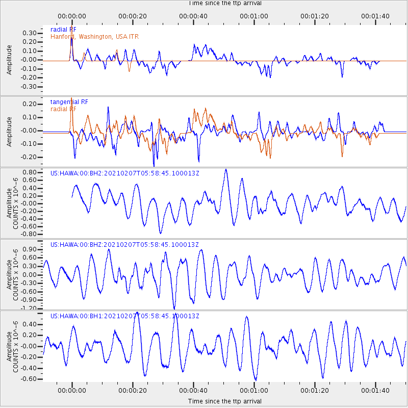
HAWA Hanford, Washington, USA - Earthquake Result Viewer
*The percent match for this event was below the threshold and hence no stack was calculated.
| Earthquake location: |
Bismarck Sea |
| Earthquake latitude/longitude: |
-3.3/146.1 |
| Earthquake time(UTC): |
2021/02/07 (038) 05:45:52 GMT |
| Earthquake Depth: |
10 km |
| Earthquake Magnitude: |
6.3 Mww |
| Earthquake Catalog/Contributor: |
NEIC PDE/us |
|
| Network: |
US United States National Seismic Network |
| Station: |
HAWA Hanford, Washington, USA |
| Lat/Lon: |
46.39 N/119.53 W |
| Elevation: |
364 m |
|
| Distance: |
95.4 deg |
| Az: |
43.882 deg |
| Baz: |
270.915 deg |
| Ray Param: |
$rayparam |
*The percent match for this event was below the threshold and hence was not used in the summary stack. |
|
| Radial Match: |
51.047367 % |
| Radial Bump: |
400 |
| Transverse Match: |
65.39977 % |
| Transverse Bump: |
400 |
| SOD ConfigId: |
23341671 |
| Insert Time: |
2021-02-21 06:56:09.362 +0000 |
| GWidth: |
2.5 |
| Max Bumps: |
400 |
| Tol: |
0.001 |
|
Signal To Noise
| Channel | StoN | STA | LTA |
| US:HAWA:00:BHZ:20210207T05:58:45.100013Z | 1.4110092 | 4.0347638E-7 | 2.859488E-7 |
| US:HAWA:00:BH1:20210207T05:58:45.100013Z | 1.0434345 | 2.0225866E-7 | 1.9383936E-7 |
| US:HAWA:00:BH2:20210207T05:58:45.100013Z | 1.7908504 | 5.0297405E-7 | 2.8085765E-7 |
| Arrivals |
| Ps | |
| PpPs | |
| PsPs/PpSs | |


