You are here: Home > Network List > IU - Global Seismograph Network (GSN - IRIS/USGS) Stations List
> Station MAKZ Makanchi, Kazakhstan > Earthquake Result Viewer
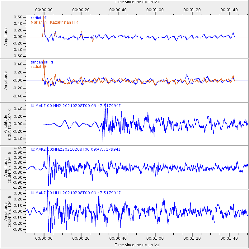
MAKZ Makanchi, Kazakhstan - Earthquake Result Viewer
*The percent match for this event was below the threshold and hence no stack was calculated.
| Earthquake location: |
Philippine Islands Region |
| Earthquake latitude/longitude: |
5.7/127.1 |
| Earthquake time(UTC): |
2021/02/08 (039) 00:00:42 GMT |
| Earthquake Depth: |
51 km |
| Earthquake Magnitude: |
5.6 Mww |
| Earthquake Catalog/Contributor: |
NEIC PDE/us |
|
| Network: |
IU Global Seismograph Network (GSN - IRIS/USGS) |
| Station: |
MAKZ Makanchi, Kazakhstan |
| Lat/Lon: |
46.81 N/81.98 E |
| Elevation: |
600 m |
|
| Distance: |
56.3 deg |
| Az: |
324.236 deg |
| Baz: |
122.146 deg |
| Ray Param: |
$rayparam |
*The percent match for this event was below the threshold and hence was not used in the summary stack. |
|
| Radial Match: |
74.90555 % |
| Radial Bump: |
400 |
| Transverse Match: |
65.734856 % |
| Transverse Bump: |
400 |
| SOD ConfigId: |
23341671 |
| Insert Time: |
2021-02-22 01:06:16.493 +0000 |
| GWidth: |
2.5 |
| Max Bumps: |
400 |
| Tol: |
0.001 |
|
Signal To Noise
| Channel | StoN | STA | LTA |
| IU:MAKZ:00:HHZ:20210208T00:09:47.517994Z | 8.460579 | 4.50818E-7 | 5.3284534E-8 |
| IU:MAKZ:00:HH1:20210208T00:09:47.517994Z | 2.6704104 | 1.4832438E-7 | 5.5543662E-8 |
| IU:MAKZ:00:HH2:20210208T00:09:47.517994Z | 4.916265 | 2.2292919E-7 | 4.534523E-8 |
| Arrivals |
| Ps | |
| PpPs | |
| PsPs/PpSs | |


