You are here: Home > Network List > TA - USArray Transportable Network (new EarthScope stations) Stations List
> Station I30M Mount Dempster, Yukon, CAN > Earthquake Result Viewer
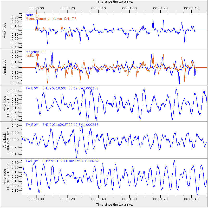
I30M Mount Dempster, Yukon, CAN - Earthquake Result Viewer
*The percent match for this event was below the threshold and hence no stack was calculated.
| Earthquake location: |
Philippine Islands Region |
| Earthquake latitude/longitude: |
5.7/127.1 |
| Earthquake time(UTC): |
2021/02/08 (039) 00:00:42 GMT |
| Earthquake Depth: |
51 km |
| Earthquake Magnitude: |
5.6 Mww |
| Earthquake Catalog/Contributor: |
NEIC PDE/us |
|
| Network: |
TA USArray Transportable Network (new EarthScope stations) |
| Station: |
I30M Mount Dempster, Yukon, CAN |
| Lat/Lon: |
65.22 N/136.38 W |
| Elevation: |
1399 m |
|
| Distance: |
87.6 deg |
| Az: |
24.772 deg |
| Baz: |
278.344 deg |
| Ray Param: |
$rayparam |
*The percent match for this event was below the threshold and hence was not used in the summary stack. |
|
| Radial Match: |
57.015526 % |
| Radial Bump: |
327 |
| Transverse Match: |
66.44664 % |
| Transverse Bump: |
400 |
| SOD ConfigId: |
23341671 |
| Insert Time: |
2021-02-22 01:08:12.094 +0000 |
| GWidth: |
2.5 |
| Max Bumps: |
400 |
| Tol: |
0.001 |
|
Signal To Noise
| Channel | StoN | STA | LTA |
| TA:I30M: :BHZ:20210208T00:12:54.100025Z | 0.45410076 | 9.676963E-8 | 2.1310167E-7 |
| TA:I30M: :BHN:20210208T00:12:54.100025Z | 1.3416024 | 2.0922239E-7 | 1.5594962E-7 |
| TA:I30M: :BHE:20210208T00:12:54.100025Z | 2.1784034 | 2.5933934E-7 | 1.1905019E-7 |
| Arrivals |
| Ps | |
| PpPs | |
| PsPs/PpSs | |


