You are here: Home > Network List > TA - USArray Transportable Network (new EarthScope stations) Stations List
> Station L15K Ungalak Mountain, AK, USA > Earthquake Result Viewer
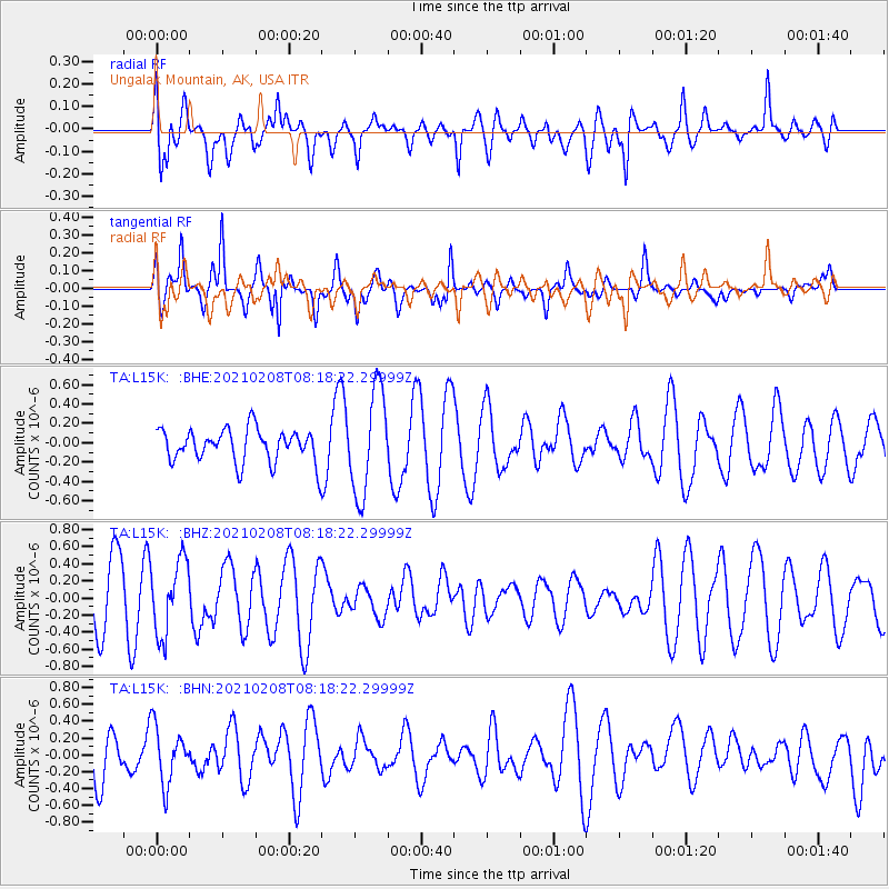
L15K Ungalak Mountain, AK, USA - Earthquake Result Viewer
*The percent match for this event was below the threshold and hence no stack was calculated.
| Earthquake location: |
Kermadec Islands Region |
| Earthquake latitude/longitude: |
-30.2/-179.4 |
| Earthquake time(UTC): |
2021/02/08 (039) 08:06:19 GMT |
| Earthquake Depth: |
340 km |
| Earthquake Magnitude: |
5.5 Mww |
| Earthquake Catalog/Contributor: |
NEIC PDE/us |
|
| Network: |
TA USArray Transportable Network (new EarthScope stations) |
| Station: |
L15K Ungalak Mountain, AK, USA |
| Lat/Lon: |
61.68 N/161.49 W |
| Elevation: |
219 m |
|
| Distance: |
92.7 deg |
| Az: |
8.453 deg |
| Baz: |
195.469 deg |
| Ray Param: |
$rayparam |
*The percent match for this event was below the threshold and hence was not used in the summary stack. |
|
| Radial Match: |
51.676567 % |
| Radial Bump: |
400 |
| Transverse Match: |
73.914856 % |
| Transverse Bump: |
351 |
| SOD ConfigId: |
23341671 |
| Insert Time: |
2021-02-22 09:16:27.523 +0000 |
| GWidth: |
2.5 |
| Max Bumps: |
400 |
| Tol: |
0.001 |
|
Signal To Noise
| Channel | StoN | STA | LTA |
| TA:L15K: :BHZ:20210208T08:18:22.29999Z | 1.1489049 | 4.2659124E-7 | 3.7130243E-7 |
| TA:L15K: :BHN:20210208T08:18:22.29999Z | 1.4977533 | 3.341309E-7 | 2.2308808E-7 |
| TA:L15K: :BHE:20210208T08:18:22.29999Z | 3.1296062 | 5.3398446E-7 | 1.7062354E-7 |
| Arrivals |
| Ps | |
| PpPs | |
| PsPs/PpSs | |


