You are here: Home > Network List > NE - New England Seismic Network Stations List
> Station EMMW Machias, ME, USA > Earthquake Result Viewer
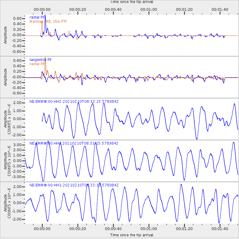
EMMW Machias, ME, USA - Earthquake Result Viewer
*The percent match for this event was below the threshold and hence no stack was calculated.
| Earthquake location: |
Central East Pacific Rise |
| Earthquake latitude/longitude: |
-13.6/-111.6 |
| Earthquake time(UTC): |
2021/02/10 (041) 08:22:31 GMT |
| Earthquake Depth: |
10 km |
| Earthquake Magnitude: |
5.6 Mww |
| Earthquake Catalog/Contributor: |
NEIC PDE/us |
|
| Network: |
NE New England Seismic Network |
| Station: |
EMMW Machias, ME, USA |
| Lat/Lon: |
44.71 N/67.46 W |
| Elevation: |
35 m |
|
| Distance: |
70.6 deg |
| Az: |
31.796 deg |
| Baz: |
225.916 deg |
| Ray Param: |
$rayparam |
*The percent match for this event was below the threshold and hence was not used in the summary stack. |
|
| Radial Match: |
88.06586 % |
| Radial Bump: |
377 |
| Transverse Match: |
54.8227 % |
| Transverse Bump: |
400 |
| SOD ConfigId: |
23341671 |
| Insert Time: |
2021-02-24 09:34:26.105 +0000 |
| GWidth: |
2.5 |
| Max Bumps: |
400 |
| Tol: |
0.001 |
|
Signal To Noise
| Channel | StoN | STA | LTA |
| NE:EMMW:00:HHZ:20210210T08:33:15.578984Z | 2.8000205 | 2.747459E-6 | 9.812281E-7 |
| NE:EMMW:00:HH1:20210210T08:33:15.578984Z | 1.5384574 | 1.2389694E-6 | 8.0533226E-7 |
| NE:EMMW:00:HH2:20210210T08:33:15.578984Z | 1.1789799 | 1.3263317E-6 | 1.1249824E-6 |
| Arrivals |
| Ps | |
| PpPs | |
| PsPs/PpSs | |


