You are here: Home > Network List > G - GEOSCOPE Stations List
> Station INU Inuyama, Japan > Earthquake Result Viewer
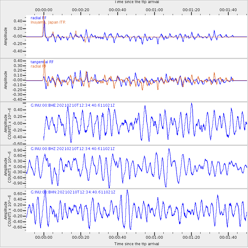
INU Inuyama, Japan - Earthquake Result Viewer
*The percent match for this event was below the threshold and hence no stack was calculated.
| Earthquake location: |
Southeast Of Loyalty Islands |
| Earthquake latitude/longitude: |
-22.9/171.7 |
| Earthquake time(UTC): |
2021/02/10 (041) 12:24:21 GMT |
| Earthquake Depth: |
10 km |
| Earthquake Magnitude: |
6.0 mww |
| Earthquake Catalog/Contributor: |
NEIC PDE/us |
|
| Network: |
G GEOSCOPE |
| Station: |
INU Inuyama, Japan |
| Lat/Lon: |
35.35 N/137.03 E |
| Elevation: |
132 m |
|
| Distance: |
66.6 deg |
| Az: |
329.577 deg |
| Baz: |
145.159 deg |
| Ray Param: |
$rayparam |
*The percent match for this event was below the threshold and hence was not used in the summary stack. |
|
| Radial Match: |
68.35586 % |
| Radial Bump: |
400 |
| Transverse Match: |
57.612095 % |
| Transverse Bump: |
400 |
| SOD ConfigId: |
23341671 |
| Insert Time: |
2021-02-24 13:32:07.341 +0000 |
| GWidth: |
2.5 |
| Max Bumps: |
400 |
| Tol: |
0.001 |
|
Signal To Noise
| Channel | StoN | STA | LTA |
| G:INU:00:BHZ:20210210T12:34:40.611021Z | 1.9894469 | 4.786184E-7 | 2.4057863E-7 |
| G:INU:00:BHN:20210210T12:34:40.611021Z | 1.4562196 | 3.5596725E-7 | 2.4444614E-7 |
| G:INU:00:BHE:20210210T12:34:40.611021Z | 1.1240897 | 2.4576335E-7 | 2.186332E-7 |
| Arrivals |
| Ps | |
| PpPs | |
| PsPs/PpSs | |


