You are here: Home > Network List > IW - Intermountain West Stations List
> Station DLMT Dillon, Montana, USA > Earthquake Result Viewer
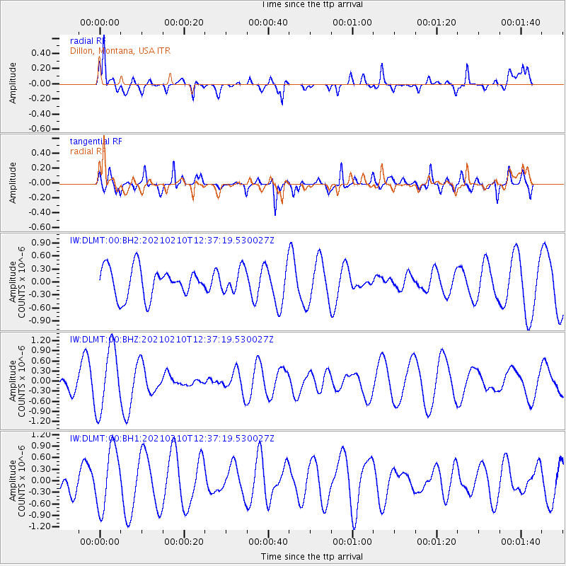
DLMT Dillon, Montana, USA - Earthquake Result Viewer
*The percent match for this event was below the threshold and hence no stack was calculated.
| Earthquake location: |
Southeast Of Loyalty Islands |
| Earthquake latitude/longitude: |
-22.9/171.7 |
| Earthquake time(UTC): |
2021/02/10 (041) 12:24:21 GMT |
| Earthquake Depth: |
10 km |
| Earthquake Magnitude: |
6.0 mww |
| Earthquake Catalog/Contributor: |
NEIC PDE/us |
|
| Network: |
IW Intermountain West |
| Station: |
DLMT Dillon, Montana, USA |
| Lat/Lon: |
45.36 N/112.60 W |
| Elevation: |
1569 m |
|
| Distance: |
96.5 deg |
| Az: |
43.453 deg |
| Baz: |
244.117 deg |
| Ray Param: |
$rayparam |
*The percent match for this event was below the threshold and hence was not used in the summary stack. |
|
| Radial Match: |
74.37354 % |
| Radial Bump: |
400 |
| Transverse Match: |
50.17921 % |
| Transverse Bump: |
400 |
| SOD ConfigId: |
23341671 |
| Insert Time: |
2021-02-24 13:33:13.351 +0000 |
| GWidth: |
2.5 |
| Max Bumps: |
400 |
| Tol: |
0.001 |
|
Signal To Noise
| Channel | StoN | STA | LTA |
| IW:DLMT:00:BHZ:20210210T12:37:19.530027Z | 3.9230237 | 9.4191444E-7 | 2.400991E-7 |
| IW:DLMT:00:BH1:20210210T12:37:19.530027Z | 2.4410853 | 8.0430596E-7 | 3.2948702E-7 |
| IW:DLMT:00:BH2:20210210T12:37:19.530027Z | 0.81684273 | 2.730527E-7 | 3.3427818E-7 |
| Arrivals |
| Ps | |
| PpPs | |
| PsPs/PpSs | |


