You are here: Home > Network List > GS - US Geological Survey Networks Stations List
> Station OK051 E0350 and S34600 Roads, Ralston, OK > Earthquake Result Viewer
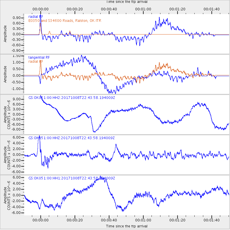
OK051 E0350 and S34600 Roads, Ralston, OK - Earthquake Result Viewer
*The percent match for this event was below the threshold and hence no stack was calculated.
| Earthquake location: |
Rat Islands, Aleutian Islands |
| Earthquake latitude/longitude: |
52.4/176.8 |
| Earthquake time(UTC): |
2017/10/08 (281) 22:34:33 GMT |
| Earthquake Depth: |
112 km |
| Earthquake Magnitude: |
6.6 mww |
| Earthquake Catalog/Contributor: |
NEIC PDE/us |
|
| Network: |
GS US Geological Survey Networks |
| Station: |
OK051 E0350 and S34600 Roads, Ralston, OK |
| Lat/Lon: |
36.51 N/96.84 W |
| Elevation: |
263 m |
|
| Distance: |
60.0 deg |
| Az: |
68.175 deg |
| Baz: |
315.157 deg |
| Ray Param: |
$rayparam |
*The percent match for this event was below the threshold and hence was not used in the summary stack. |
|
| Radial Match: |
50.76264 % |
| Radial Bump: |
400 |
| Transverse Match: |
54.47007 % |
| Transverse Bump: |
400 |
| SOD ConfigId: |
2364251 |
| Insert Time: |
2017-10-22 22:42:55.025 +0000 |
| GWidth: |
2.5 |
| Max Bumps: |
400 |
| Tol: |
0.001 |
|
Signal To Noise
| Channel | StoN | STA | LTA |
| GS:OK051:00:HHZ:20171008T22:43:58.194009Z | 19.215742 | 3.3116808E-6 | 1.7234207E-7 |
| GS:OK051:00:HH1:20171008T22:43:58.194009Z | 1.7501959 | 5.3900985E-6 | 3.0797119E-6 |
| GS:OK051:00:HH2:20171008T22:43:58.194009Z | 2.2353244 | 9.32173E-6 | 4.1701915E-6 |
| Arrivals |
| Ps | |
| PpPs | |
| PsPs/PpSs | |


