You are here: Home > Network List > UU - University of Utah Regional Network Stations List
> Station FORU South Mineral Mountains, UT, USA > Earthquake Result Viewer
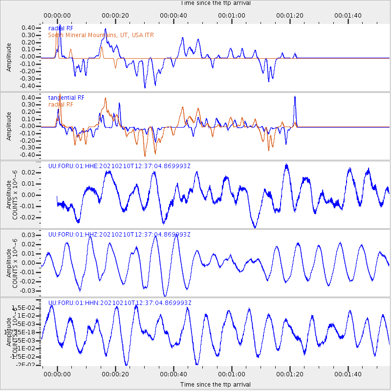
FORU South Mineral Mountains, UT, USA - Earthquake Result Viewer
*The percent match for this event was below the threshold and hence no stack was calculated.
| Earthquake location: |
Southeast Of Loyalty Islands |
| Earthquake latitude/longitude: |
-22.9/171.7 |
| Earthquake time(UTC): |
2021/02/10 (041) 12:24:21 GMT |
| Earthquake Depth: |
10 km |
| Earthquake Magnitude: |
6.0 mww |
| Earthquake Catalog/Contributor: |
NEIC PDE/us |
|
| Network: |
UU University of Utah Regional Network |
| Station: |
FORU South Mineral Mountains, UT, USA |
| Lat/Lon: |
38.46 N/112.86 W |
| Elevation: |
1840 m |
|
| Distance: |
93.3 deg |
| Az: |
49.575 deg |
| Baz: |
243.413 deg |
| Ray Param: |
$rayparam |
*The percent match for this event was below the threshold and hence was not used in the summary stack. |
|
| Radial Match: |
57.227158 % |
| Radial Bump: |
400 |
| Transverse Match: |
47.489708 % |
| Transverse Bump: |
400 |
| SOD ConfigId: |
23341671 |
| Insert Time: |
2021-02-24 13:36:31.724 +0000 |
| GWidth: |
2.5 |
| Max Bumps: |
400 |
| Tol: |
0.001 |
|
Signal To Noise
| Channel | StoN | STA | LTA |
| UU:FORU:01:HHZ:20210210T12:37:04.869993Z | 2.8110163 | 1.3686612E-8 | 4.868919E-9 |
| UU:FORU:01:HHN:20210210T12:37:04.869993Z | 1.077024 | 6.478348E-9 | 6.015045E-9 |
| UU:FORU:01:HHE:20210210T12:37:04.869993Z | 1.1430324 | 1.3178021E-8 | 1.1529E-8 |
| Arrivals |
| Ps | |
| PpPs | |
| PsPs/PpSs | |


