You are here: Home > Network List > UW - Pacific Northwest Regional Seismic Network Stations List
> Station HOOD Mt Hood Meadows, OR CREST BB SMO > Earthquake Result Viewer
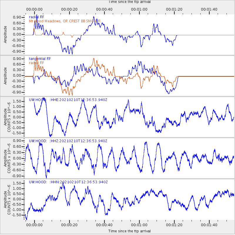
HOOD Mt Hood Meadows, OR CREST BB SMO - Earthquake Result Viewer
*The percent match for this event was below the threshold and hence no stack was calculated.
| Earthquake location: |
Southeast Of Loyalty Islands |
| Earthquake latitude/longitude: |
-22.9/171.7 |
| Earthquake time(UTC): |
2021/02/10 (041) 12:24:21 GMT |
| Earthquake Depth: |
10 km |
| Earthquake Magnitude: |
6.0 mww |
| Earthquake Catalog/Contributor: |
NEIC PDE/us |
|
| Network: |
UW Pacific Northwest Regional Seismic Network |
| Station: |
HOOD Mt Hood Meadows, OR CREST BB SMO |
| Lat/Lon: |
45.32 N/121.65 W |
| Elevation: |
1520 m |
|
| Distance: |
90.9 deg |
| Az: |
40.388 deg |
| Baz: |
237.89 deg |
| Ray Param: |
$rayparam |
*The percent match for this event was below the threshold and hence was not used in the summary stack. |
|
| Radial Match: |
57.72698 % |
| Radial Bump: |
400 |
| Transverse Match: |
48.990215 % |
| Transverse Bump: |
400 |
| SOD ConfigId: |
23341671 |
| Insert Time: |
2021-02-24 13:36:57.103 +0000 |
| GWidth: |
2.5 |
| Max Bumps: |
400 |
| Tol: |
0.001 |
|
Signal To Noise
| Channel | StoN | STA | LTA |
| UW:HOOD: :HHZ:20210210T12:36:53.940Z | 1.4652007 | 5.757431E-7 | 3.9294488E-7 |
| UW:HOOD: :HHN:20210210T12:36:53.940Z | 2.3741708 | 1.5086853E-6 | 6.3545775E-7 |
| UW:HOOD: :HHE:20210210T12:36:53.940Z | 0.80160445 | 7.758263E-7 | 9.678419E-7 |
| Arrivals |
| Ps | |
| PpPs | |
| PsPs/PpSs | |


