You are here: Home > Network List > CI - Caltech Regional Seismic Network Stations List
> Station TUQ Turquiose Mountain, Baker, CA, USA > Earthquake Result Viewer
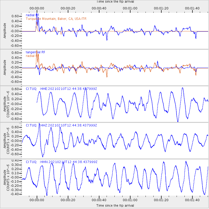
TUQ Turquiose Mountain, Baker, CA, USA - Earthquake Result Viewer
*The percent match for this event was below the threshold and hence no stack was calculated.
| Earthquake location: |
Southeast Of Loyalty Islands |
| Earthquake latitude/longitude: |
-22.6/171.5 |
| Earthquake time(UTC): |
2021/02/10 (041) 12:32:11 GMT |
| Earthquake Depth: |
10 km |
| Earthquake Magnitude: |
5.7 mww |
| Earthquake Catalog/Contributor: |
NEIC PDE/us |
|
| Network: |
CI Caltech Regional Seismic Network |
| Station: |
TUQ Turquiose Mountain, Baker, CA, USA |
| Lat/Lon: |
35.44 N/115.92 W |
| Elevation: |
1350 m |
|
| Distance: |
89.7 deg |
| Az: |
51.199 deg |
| Baz: |
241.914 deg |
| Ray Param: |
$rayparam |
*The percent match for this event was below the threshold and hence was not used in the summary stack. |
|
| Radial Match: |
56.9471 % |
| Radial Bump: |
400 |
| Transverse Match: |
46.138172 % |
| Transverse Bump: |
330 |
| SOD ConfigId: |
23341671 |
| Insert Time: |
2021-02-24 13:43:01.796 +0000 |
| GWidth: |
2.5 |
| Max Bumps: |
400 |
| Tol: |
0.001 |
|
Signal To Noise
| Channel | StoN | STA | LTA |
| CI:TUQ: :HHZ:20210210T12:44:38.437999Z | 1.935751 | 4.6634355E-7 | 2.4091094E-7 |
| CI:TUQ: :HHN:20210210T12:44:38.437999Z | 0.8084119 | 1.9230465E-7 | 2.3787955E-7 |
| CI:TUQ: :HHE:20210210T12:44:38.437999Z | 1.3837535 | 4.2618964E-7 | 3.0799535E-7 |
| Arrivals |
| Ps | |
| PpPs | |
| PsPs/PpSs | |


