You are here: Home > Network List > IU - Global Seismograph Network (GSN - IRIS/USGS) Stations List
> Station XMAS Kiritimati Island, Republic of Kiribati > Earthquake Result Viewer
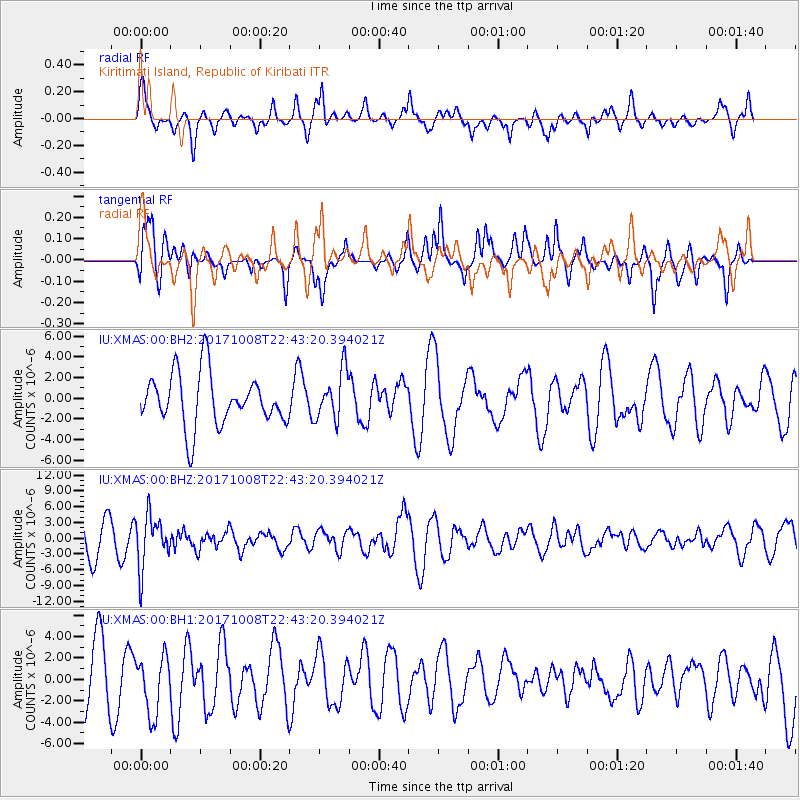
XMAS Kiritimati Island, Republic of Kiribati - Earthquake Result Viewer
*The percent match for this event was below the threshold and hence no stack was calculated.
| Earthquake location: |
Rat Islands, Aleutian Islands |
| Earthquake latitude/longitude: |
52.4/176.8 |
| Earthquake time(UTC): |
2017/10/08 (281) 22:34:33 GMT |
| Earthquake Depth: |
112 km |
| Earthquake Magnitude: |
6.6 mww |
| Earthquake Catalog/Contributor: |
NEIC PDE/us |
|
| Network: |
IU Global Seismograph Network (GSN - IRIS/USGS) |
| Station: |
XMAS Kiritimati Island, Republic of Kiribati |
| Lat/Lon: |
2.04 N/157.45 W |
| Elevation: |
20 m |
|
| Distance: |
54.6 deg |
| Az: |
147.831 deg |
| Baz: |
340.97 deg |
| Ray Param: |
$rayparam |
*The percent match for this event was below the threshold and hence was not used in the summary stack. |
|
| Radial Match: |
57.015606 % |
| Radial Bump: |
400 |
| Transverse Match: |
48.485928 % |
| Transverse Bump: |
324 |
| SOD ConfigId: |
2364251 |
| Insert Time: |
2017-10-22 22:45:25.302 +0000 |
| GWidth: |
2.5 |
| Max Bumps: |
400 |
| Tol: |
0.001 |
|
Signal To Noise
| Channel | StoN | STA | LTA |
| IU:XMAS:00:BHZ:20171008T22:43:20.394021Z | 1.769154 | 4.9116766E-6 | 2.7762856E-6 |
| IU:XMAS:00:BH1:20171008T22:43:20.394021Z | 1.1404754 | 2.7008111E-6 | 2.368145E-6 |
| IU:XMAS:00:BH2:20171008T22:43:20.394021Z | 0.9479919 | 2.373487E-6 | 2.5036995E-6 |
| Arrivals |
| Ps | |
| PpPs | |
| PsPs/PpSs | |


