You are here: Home > Network List > WY - Yellowstone Wyoming Seismic Network Stations List
> Station YNR Norris Junction, YNP, WY, USA > Earthquake Result Viewer
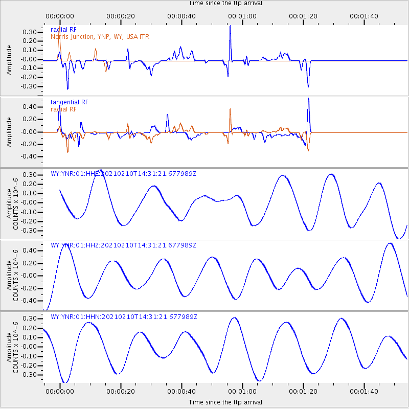
YNR Norris Junction, YNP, WY, USA - Earthquake Result Viewer
*The percent match for this event was below the threshold and hence no stack was calculated.
| Earthquake location: |
Southeast Of Loyalty Islands |
| Earthquake latitude/longitude: |
-22.7/171.8 |
| Earthquake time(UTC): |
2021/02/10 (041) 14:18:20 GMT |
| Earthquake Depth: |
10 km |
| Earthquake Magnitude: |
5.6 mb |
| Earthquake Catalog/Contributor: |
NEIC PDE/us |
|
| Network: |
WY Yellowstone Wyoming Seismic Network |
| Station: |
YNR Norris Junction, YNP, WY, USA |
| Lat/Lon: |
44.72 N/110.68 W |
| Elevation: |
2336 m |
|
| Distance: |
97.3 deg |
| Az: |
44.576 deg |
| Baz: |
245.382 deg |
| Ray Param: |
$rayparam |
*The percent match for this event was below the threshold and hence was not used in the summary stack. |
|
| Radial Match: |
85.22528 % |
| Radial Bump: |
265 |
| Transverse Match: |
67.61552 % |
| Transverse Bump: |
400 |
| SOD ConfigId: |
23341671 |
| Insert Time: |
2021-02-24 15:30:47.564 +0000 |
| GWidth: |
2.5 |
| Max Bumps: |
400 |
| Tol: |
0.001 |
|
Signal To Noise
| Channel | StoN | STA | LTA |
| WY:YNR:01:HHZ:20210210T14:31:21.677989Z | 1.1728435 | 3.956918E-7 | 3.373782E-7 |
| WY:YNR:01:HHN:20210210T14:31:21.677989Z | 3.3010268 | 2.9772448E-7 | 9.019147E-8 |
| WY:YNR:01:HHE:20210210T14:31:21.677989Z | 0.82376677 | 1.5169175E-7 | 1.8414404E-7 |
| Arrivals |
| Ps | |
| PpPs | |
| PsPs/PpSs | |


