You are here: Home > Network List > CI - Caltech Regional Seismic Network Stations List
> Station TIN Tinemaha, Big Pine, CA, USA > Earthquake Result Viewer
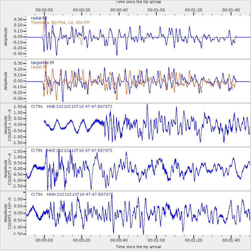
TIN Tinemaha, Big Pine, CA, USA - Earthquake Result Viewer
*The percent match for this event was below the threshold and hence no stack was calculated.
| Earthquake location: |
Southeast Of Loyalty Islands |
| Earthquake latitude/longitude: |
-22.8/171.1 |
| Earthquake time(UTC): |
2021/02/10 (041) 16:35:23 GMT |
| Earthquake Depth: |
10 km |
| Earthquake Magnitude: |
6.1 mww |
| Earthquake Catalog/Contributor: |
NEIC PDE/us |
|
| Network: |
CI Caltech Regional Seismic Network |
| Station: |
TIN Tinemaha, Big Pine, CA, USA |
| Lat/Lon: |
37.05 N/118.23 W |
| Elevation: |
1197 m |
|
| Distance: |
89.3 deg |
| Az: |
49.032 deg |
| Baz: |
240.542 deg |
| Ray Param: |
$rayparam |
*The percent match for this event was below the threshold and hence was not used in the summary stack. |
|
| Radial Match: |
57.64739 % |
| Radial Bump: |
400 |
| Transverse Match: |
63.91147 % |
| Transverse Bump: |
400 |
| SOD ConfigId: |
23341671 |
| Insert Time: |
2021-02-24 17:42:35.570 +0000 |
| GWidth: |
2.5 |
| Max Bumps: |
400 |
| Tol: |
0.001 |
|
Signal To Noise
| Channel | StoN | STA | LTA |
| CI:TIN: :HHZ:20210210T16:47:47.89797Z | 2.2280538 | 7.995261E-7 | 3.5884506E-7 |
| CI:TIN: :HHN:20210210T16:47:47.89797Z | 1.0658252 | 2.7200088E-7 | 2.5520214E-7 |
| CI:TIN: :HHE:20210210T16:47:47.89797Z | 1.6060208 | 4.663357E-7 | 2.9036715E-7 |
| Arrivals |
| Ps | |
| PpPs | |
| PsPs/PpSs | |


