You are here: Home > Network List > II - Global Seismograph Network (GSN - IRIS/IDA) Stations List
> Station PFO Pinon Flat, California, USA > Earthquake Result Viewer
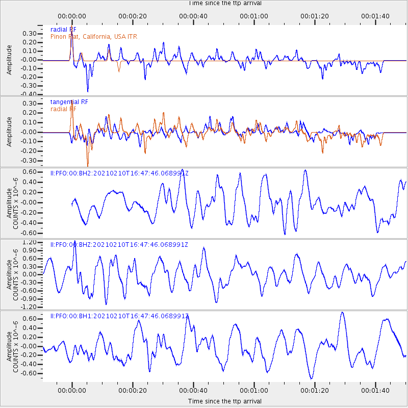
PFO Pinon Flat, California, USA - Earthquake Result Viewer
*The percent match for this event was below the threshold and hence no stack was calculated.
| Earthquake location: |
Southeast Of Loyalty Islands |
| Earthquake latitude/longitude: |
-22.8/171.1 |
| Earthquake time(UTC): |
2021/02/10 (041) 16:35:23 GMT |
| Earthquake Depth: |
10 km |
| Earthquake Magnitude: |
6.1 mww |
| Earthquake Catalog/Contributor: |
NEIC PDE/us |
|
| Network: |
II Global Seismograph Network (GSN - IRIS/IDA) |
| Station: |
PFO Pinon Flat, California, USA |
| Lat/Lon: |
33.61 N/116.46 W |
| Elevation: |
1280 m |
|
| Distance: |
88.9 deg |
| Az: |
52.741 deg |
| Baz: |
241.623 deg |
| Ray Param: |
$rayparam |
*The percent match for this event was below the threshold and hence was not used in the summary stack. |
|
| Radial Match: |
56.941055 % |
| Radial Bump: |
343 |
| Transverse Match: |
65.272995 % |
| Transverse Bump: |
400 |
| SOD ConfigId: |
23341671 |
| Insert Time: |
2021-02-24 17:44:11.045 +0000 |
| GWidth: |
2.5 |
| Max Bumps: |
400 |
| Tol: |
0.001 |
|
Signal To Noise
| Channel | StoN | STA | LTA |
| II:PFO:00:BHZ:20210210T16:47:46.068991Z | 1.8939446 | 5.4865905E-7 | 2.8969117E-7 |
| II:PFO:00:BH1:20210210T16:47:46.068991Z | 1.3546269 | 2.8372762E-7 | 2.0945076E-7 |
| II:PFO:00:BH2:20210210T16:47:46.068991Z | 1.3264909 | 2.358123E-7 | 1.7777153E-7 |
| Arrivals |
| Ps | |
| PpPs | |
| PsPs/PpSs | |


