You are here: Home > Network List > TA - USArray Transportable Network (new EarthScope stations) Stations List
> Station F14K Arctic Creek, AK, USA > Earthquake Result Viewer
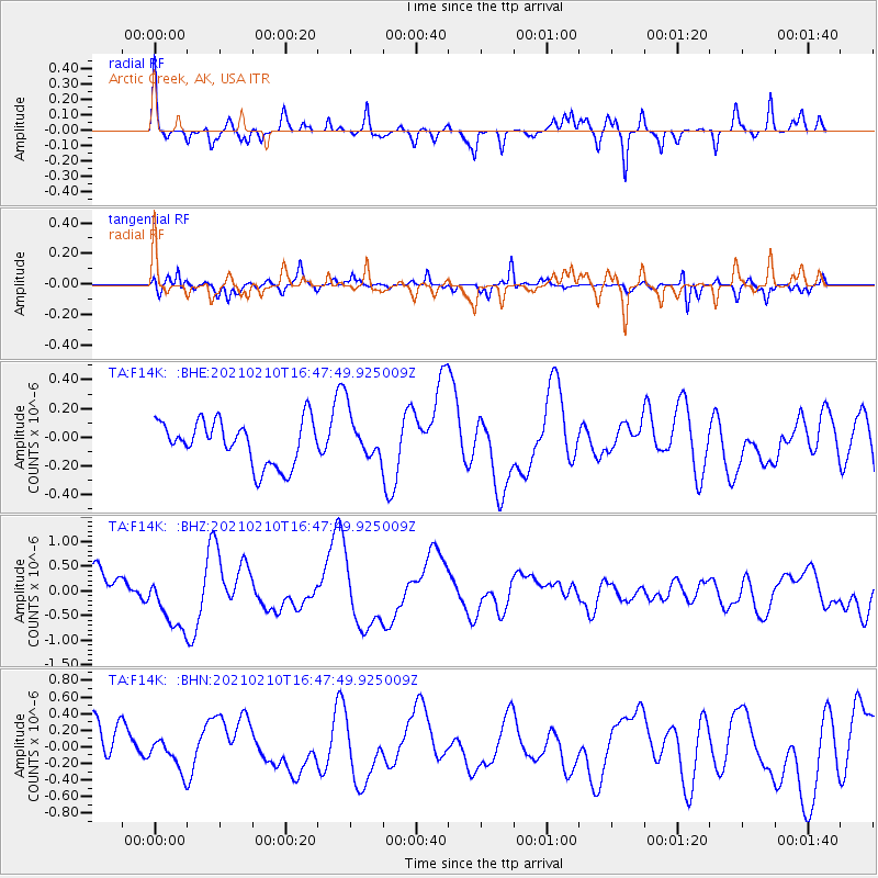
F14K Arctic Creek, AK, USA - Earthquake Result Viewer
*The percent match for this event was below the threshold and hence no stack was calculated.
| Earthquake location: |
Southeast Of Loyalty Islands |
| Earthquake latitude/longitude: |
-22.8/171.1 |
| Earthquake time(UTC): |
2021/02/10 (041) 16:35:23 GMT |
| Earthquake Depth: |
10 km |
| Earthquake Magnitude: |
6.1 mww |
| Earthquake Catalog/Contributor: |
NEIC PDE/us |
|
| Network: |
TA USArray Transportable Network (new EarthScope stations) |
| Station: |
F14K Arctic Creek, AK, USA |
| Lat/Lon: |
65.47 N/166.33 W |
| Elevation: |
266 m |
|
| Distance: |
89.7 deg |
| Az: |
9.229 deg |
| Baz: |
200.759 deg |
| Ray Param: |
$rayparam |
*The percent match for this event was below the threshold and hence was not used in the summary stack. |
|
| Radial Match: |
73.623245 % |
| Radial Bump: |
267 |
| Transverse Match: |
63.979485 % |
| Transverse Bump: |
275 |
| SOD ConfigId: |
23341671 |
| Insert Time: |
2021-02-24 17:46:42.730 +0000 |
| GWidth: |
2.5 |
| Max Bumps: |
400 |
| Tol: |
0.001 |
|
Signal To Noise
| Channel | StoN | STA | LTA |
| TA:F14K: :BHZ:20210210T16:47:49.925009Z | 2.0185285 | 6.495412E-7 | 3.2178949E-7 |
| TA:F14K: :BHN:20210210T16:47:49.925009Z | 0.74713933 | 1.884169E-7 | 2.5218444E-7 |
| TA:F14K: :BHE:20210210T16:47:49.925009Z | 1.0627612 | 1.6184725E-7 | 1.5228937E-7 |
| Arrivals |
| Ps | |
| PpPs | |
| PsPs/PpSs | |


