You are here: Home > Network List > TA - USArray Transportable Network (new EarthScope stations) Stations List
> Station L15K Ungalak Mountain, AK, USA > Earthquake Result Viewer
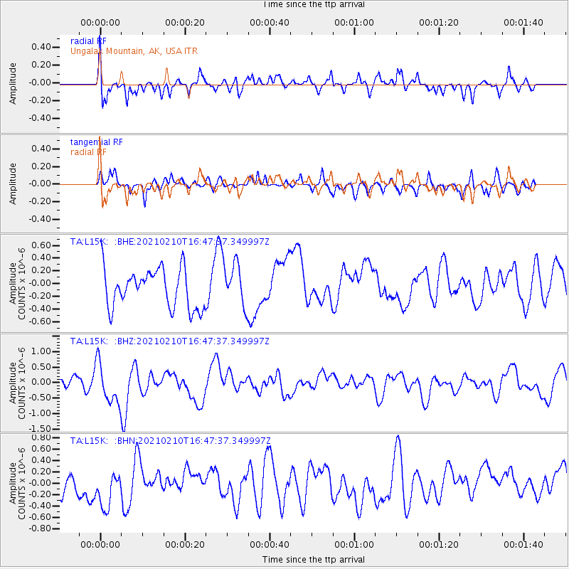
L15K Ungalak Mountain, AK, USA - Earthquake Result Viewer
*The percent match for this event was below the threshold and hence no stack was calculated.
| Earthquake location: |
Southeast Of Loyalty Islands |
| Earthquake latitude/longitude: |
-22.8/171.1 |
| Earthquake time(UTC): |
2021/02/10 (041) 16:35:23 GMT |
| Earthquake Depth: |
10 km |
| Earthquake Magnitude: |
6.1 mww |
| Earthquake Catalog/Contributor: |
NEIC PDE/us |
|
| Network: |
TA USArray Transportable Network (new EarthScope stations) |
| Station: |
L15K Ungalak Mountain, AK, USA |
| Lat/Lon: |
61.68 N/161.49 W |
| Elevation: |
219 m |
|
| Distance: |
87.1 deg |
| Az: |
12.711 deg |
| Baz: |
205.19 deg |
| Ray Param: |
$rayparam |
*The percent match for this event was below the threshold and hence was not used in the summary stack. |
|
| Radial Match: |
56.944115 % |
| Radial Bump: |
397 |
| Transverse Match: |
40.27791 % |
| Transverse Bump: |
346 |
| SOD ConfigId: |
23341671 |
| Insert Time: |
2021-02-24 17:47:02.333 +0000 |
| GWidth: |
2.5 |
| Max Bumps: |
400 |
| Tol: |
0.001 |
|
Signal To Noise
| Channel | StoN | STA | LTA |
| TA:L15K: :BHZ:20210210T16:47:37.349997Z | 1.8539654 | 6.8359003E-7 | 3.687178E-7 |
| TA:L15K: :BHN:20210210T16:47:37.349997Z | 0.6496863 | 3.3689193E-7 | 5.1854556E-7 |
| TA:L15K: :BHE:20210210T16:47:37.349997Z | 1.1036392 | 3.422123E-7 | 3.1007622E-7 |
| Arrivals |
| Ps | |
| PpPs | |
| PsPs/PpSs | |


