You are here: Home > Network List > US - United States National Seismic Network Stations List
> Station ELK Elko, Nevada, USA > Earthquake Result Viewer
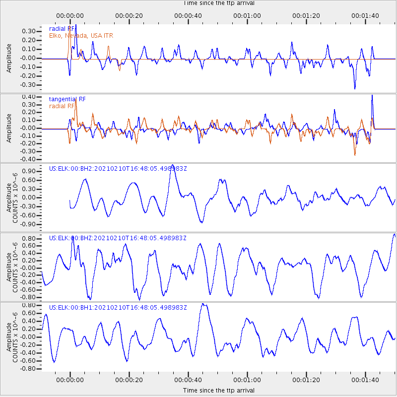
ELK Elko, Nevada, USA - Earthquake Result Viewer
*The percent match for this event was below the threshold and hence no stack was calculated.
| Earthquake location: |
Southeast Of Loyalty Islands |
| Earthquake latitude/longitude: |
-22.8/171.1 |
| Earthquake time(UTC): |
2021/02/10 (041) 16:35:23 GMT |
| Earthquake Depth: |
10 km |
| Earthquake Magnitude: |
6.1 mww |
| Earthquake Catalog/Contributor: |
NEIC PDE/us |
|
| Network: |
US United States National Seismic Network |
| Station: |
ELK Elko, Nevada, USA |
| Lat/Lon: |
40.74 N/115.24 W |
| Elevation: |
2210 m |
|
| Distance: |
93.1 deg |
| Az: |
46.908 deg |
| Baz: |
242.458 deg |
| Ray Param: |
$rayparam |
*The percent match for this event was below the threshold and hence was not used in the summary stack. |
|
| Radial Match: |
56.798595 % |
| Radial Bump: |
400 |
| Transverse Match: |
52.38788 % |
| Transverse Bump: |
400 |
| SOD ConfigId: |
23341671 |
| Insert Time: |
2021-02-24 17:48:22.881 +0000 |
| GWidth: |
2.5 |
| Max Bumps: |
400 |
| Tol: |
0.001 |
|
Signal To Noise
| Channel | StoN | STA | LTA |
| US:ELK:00:BHZ:20210210T16:48:05.498983Z | 1.4527788 | 4.8632774E-7 | 3.3475692E-7 |
| US:ELK:00:BH1:20210210T16:48:05.498983Z | 0.5244459 | 1.6783925E-7 | 3.2003157E-7 |
| US:ELK:00:BH2:20210210T16:48:05.498983Z | 1.6432887 | 5.6751907E-7 | 3.4535566E-7 |
| Arrivals |
| Ps | |
| PpPs | |
| PsPs/PpSs | |


