You are here: Home > Network List > AZ - ANZA Regional Network Stations List
> Station SMER AZ.SMER > Earthquake Result Viewer
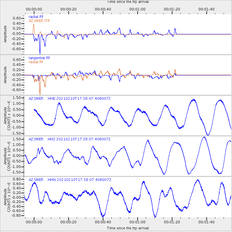
SMER AZ.SMER - Earthquake Result Viewer
*The percent match for this event was below the threshold and hence no stack was calculated.
| Earthquake location: |
Southeast Of Loyalty Islands |
| Earthquake latitude/longitude: |
-22.7/171.7 |
| Earthquake time(UTC): |
2021/02/10 (041) 17:25:49 GMT |
| Earthquake Depth: |
10 km |
| Earthquake Magnitude: |
5.6 mb |
| Earthquake Catalog/Contributor: |
NEIC PDE/us |
|
| Network: |
AZ ANZA Regional Network |
| Station: |
SMER AZ.SMER |
| Lat/Lon: |
33.46 N/117.17 W |
| Elevation: |
355 m |
|
| Distance: |
87.7 deg |
| Az: |
52.33 deg |
| Baz: |
240.96 deg |
| Ray Param: |
$rayparam |
*The percent match for this event was below the threshold and hence was not used in the summary stack. |
|
| Radial Match: |
92.50528 % |
| Radial Bump: |
400 |
| Transverse Match: |
63.985714 % |
| Transverse Bump: |
400 |
| SOD ConfigId: |
23341671 |
| Insert Time: |
2021-02-24 18:29:45.173 +0000 |
| GWidth: |
2.5 |
| Max Bumps: |
400 |
| Tol: |
0.001 |
|
Signal To Noise
| Channel | StoN | STA | LTA |
| AZ:SMER: :HHZ:20210210T17:38:07.408007Z | 1.2780545 | 4.2419967E-7 | 3.3191048E-7 |
| AZ:SMER: :HHN:20210210T17:38:07.408007Z | 2.2309194 | 5.9934115E-7 | 2.686521E-7 |
| AZ:SMER: :HHE:20210210T17:38:07.408007Z | 1.1224296 | 5.823305E-7 | 5.1881244E-7 |
| Arrivals |
| Ps | |
| PpPs | |
| PsPs/PpSs | |


