You are here: Home > Network List > CI - Caltech Regional Seismic Network Stations List
> Station MPM Manuel Prospect Mine, California, USA > Earthquake Result Viewer
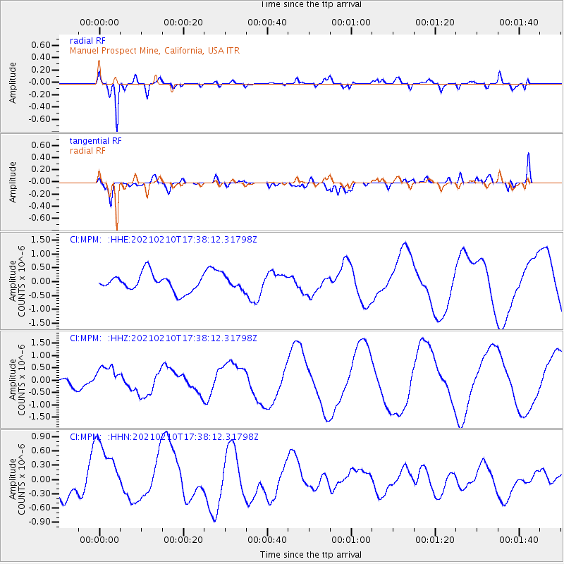
MPM Manuel Prospect Mine, California, USA - Earthquake Result Viewer
*The percent match for this event was below the threshold and hence no stack was calculated.
| Earthquake location: |
Southeast Of Loyalty Islands |
| Earthquake latitude/longitude: |
-22.7/171.7 |
| Earthquake time(UTC): |
2021/02/10 (041) 17:25:49 GMT |
| Earthquake Depth: |
10 km |
| Earthquake Magnitude: |
5.6 mb |
| Earthquake Catalog/Contributor: |
NEIC PDE/us |
|
| Network: |
CI Caltech Regional Seismic Network |
| Station: |
MPM Manuel Prospect Mine, California, USA |
| Lat/Lon: |
36.06 N/117.49 W |
| Elevation: |
185 m |
|
| Distance: |
88.8 deg |
| Az: |
49.936 deg |
| Baz: |
240.707 deg |
| Ray Param: |
$rayparam |
*The percent match for this event was below the threshold and hence was not used in the summary stack. |
|
| Radial Match: |
88.73814 % |
| Radial Bump: |
400 |
| Transverse Match: |
71.04996 % |
| Transverse Bump: |
400 |
| SOD ConfigId: |
23341671 |
| Insert Time: |
2021-02-24 18:31:44.211 +0000 |
| GWidth: |
2.5 |
| Max Bumps: |
400 |
| Tol: |
0.001 |
|
Signal To Noise
| Channel | StoN | STA | LTA |
| CI:MPM: :HHZ:20210210T17:38:12.31798Z | 1.4893765 | 4.925854E-7 | 3.307326E-7 |
| CI:MPM: :HHN:20210210T17:38:12.31798Z | 1.8648325 | 7.428705E-7 | 3.9835774E-7 |
| CI:MPM: :HHE:20210210T17:38:12.31798Z | 0.74192125 | 2.295177E-7 | 3.0935587E-7 |
| Arrivals |
| Ps | |
| PpPs | |
| PsPs/PpSs | |


