You are here: Home > Network List > CI - Caltech Regional Seismic Network Stations List
> Station MUR Murrieta > Earthquake Result Viewer
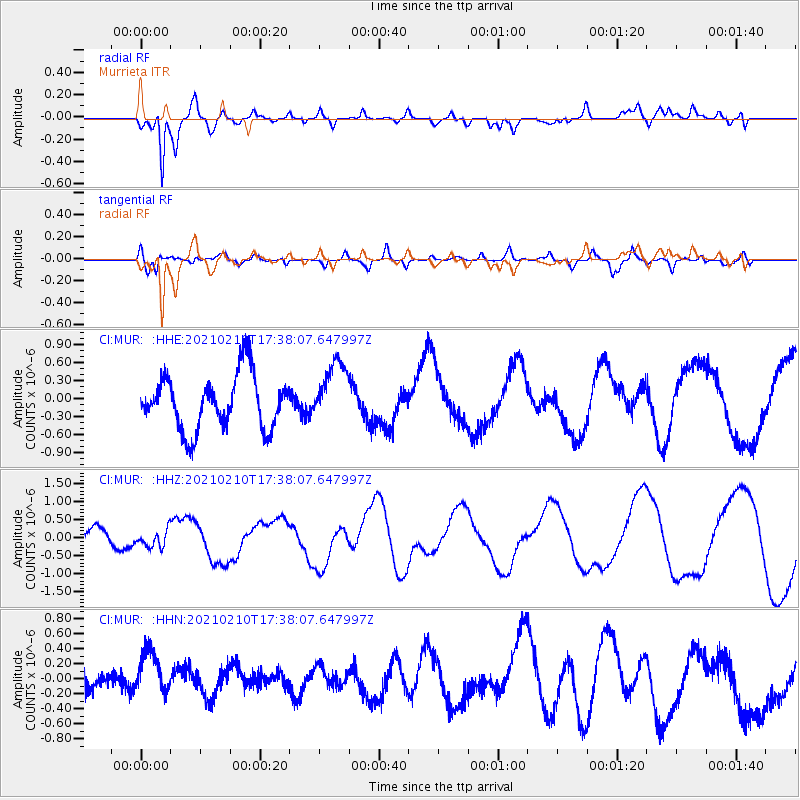
MUR Murrieta - Earthquake Result Viewer
*The percent match for this event was below the threshold and hence no stack was calculated.
| Earthquake location: |
Southeast Of Loyalty Islands |
| Earthquake latitude/longitude: |
-22.7/171.7 |
| Earthquake time(UTC): |
2021/02/10 (041) 17:25:49 GMT |
| Earthquake Depth: |
10 km |
| Earthquake Magnitude: |
5.6 mb |
| Earthquake Catalog/Contributor: |
NEIC PDE/us |
|
| Network: |
CI Caltech Regional Seismic Network |
| Station: |
MUR Murrieta |
| Lat/Lon: |
33.60 N/117.20 W |
| Elevation: |
562 m |
|
| Distance: |
87.8 deg |
| Az: |
52.196 deg |
| Baz: |
240.941 deg |
| Ray Param: |
$rayparam |
*The percent match for this event was below the threshold and hence was not used in the summary stack. |
|
| Radial Match: |
91.6474 % |
| Radial Bump: |
400 |
| Transverse Match: |
51.412758 % |
| Transverse Bump: |
400 |
| SOD ConfigId: |
23341671 |
| Insert Time: |
2021-02-24 18:31:46.327 +0000 |
| GWidth: |
2.5 |
| Max Bumps: |
400 |
| Tol: |
0.001 |
|
Signal To Noise
| Channel | StoN | STA | LTA |
| CI:MUR: :HHZ:20210210T17:38:07.647997Z | 0.75508904 | 2.339164E-7 | 3.0978651E-7 |
| CI:MUR: :HHN:20210210T17:38:07.647997Z | 1.4347407 | 3.376533E-7 | 2.3534099E-7 |
| CI:MUR: :HHE:20210210T17:38:07.647997Z | 1.1446086 | 5.1637636E-7 | 4.511379E-7 |
| Arrivals |
| Ps | |
| PpPs | |
| PsPs/PpSs | |


