You are here: Home > Network List > IW - Intermountain West Stations List
> Station PLID Pearl Lake, Idaho, USA > Earthquake Result Viewer
PLID Pearl Lake, Idaho, USA - Earthquake Result Viewer
*The percent match for this event was below the threshold and hence no stack was calculated.
| Earthquake location: |
Southeast Of Loyalty Islands |
| Earthquake latitude/longitude: |
-22.7/171.7 |
| Earthquake time(UTC): |
2021/02/10 (041) 17:25:49 GMT |
| Earthquake Depth: |
10 km |
| Earthquake Magnitude: |
5.6 mb |
| Earthquake Catalog/Contributor: |
NEIC PDE/us |
|
| Network: |
IW Intermountain West |
| Station: |
PLID Pearl Lake, Idaho, USA |
| Lat/Lon: |
45.09 N/116.00 W |
| Elevation: |
2164 m |
|
| Distance: |
94.1 deg |
| Az: |
42.572 deg |
| Baz: |
241.861 deg |
| Ray Param: |
$rayparam |
*The percent match for this event was below the threshold and hence was not used in the summary stack. |
|
| Radial Match: |
70.4298 % |
| Radial Bump: |
274 |
| Transverse Match: |
74.21124 % |
| Transverse Bump: |
318 |
| SOD ConfigId: |
23341671 |
| Insert Time: |
2021-02-24 18:33:46.781 +0000 |
| GWidth: |
2.5 |
| Max Bumps: |
400 |
| Tol: |
0.001 |
|
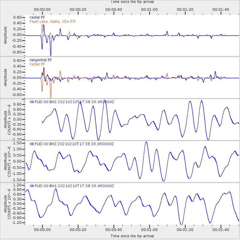
Signal To Noise
| Channel | StoN | STA | LTA |
| IW:PLID:00:BHZ:20210210T17:38:36.960009Z | 0.5256472 | 3.707185E-7 | 7.052611E-7 |
| IW:PLID:00:BH1:20210210T17:38:36.960009Z | 1.1426331 | 6.105798E-7 | 5.343621E-7 |
| IW:PLID:00:BH2:20210210T17:38:36.960009Z | 1.4517337 | 7.9940787E-7 | 5.506574E-7 |
| Arrivals |
| Ps | |
| PpPs | |
| PsPs/PpSs | |


