You are here: Home > Network List > CI - Caltech Regional Seismic Network Stations List
> Station FMP Fort MacArthur Park, Pt. Fermin San Pedro, CA, USA > Earthquake Result Viewer
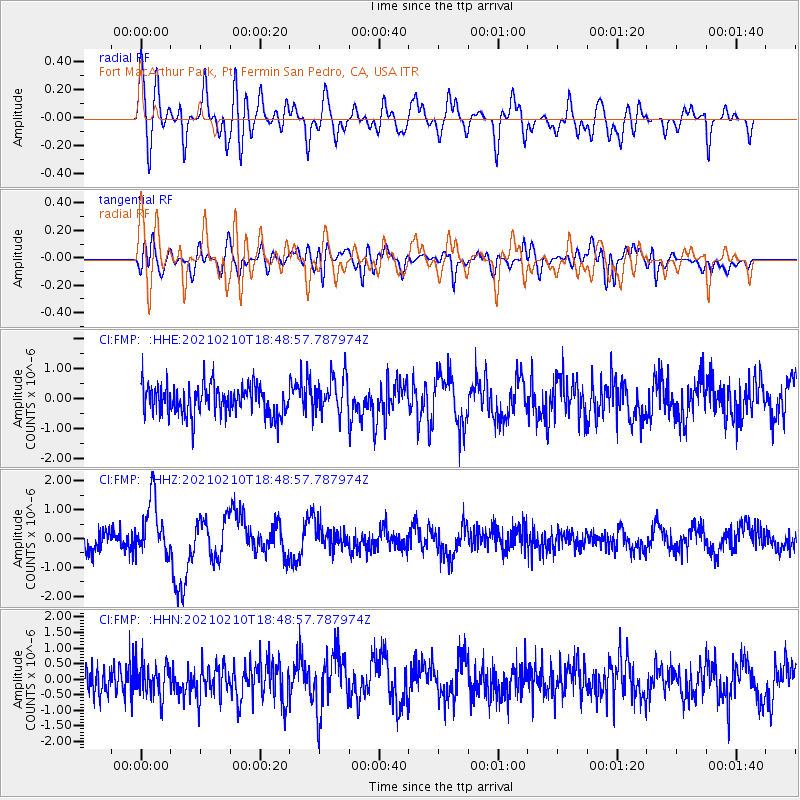
FMP Fort MacArthur Park, Pt. Fermin San Pedro, CA, USA - Earthquake Result Viewer
*The percent match for this event was below the threshold and hence no stack was calculated.
| Earthquake location: |
Southeast Of Loyalty Islands |
| Earthquake latitude/longitude: |
-22.8/171.1 |
| Earthquake time(UTC): |
2021/02/10 (041) 18:36:41 GMT |
| Earthquake Depth: |
10 km |
| Earthquake Magnitude: |
6.1 mww |
| Earthquake Catalog/Contributor: |
NEIC PDE/us |
|
| Network: |
CI Caltech Regional Seismic Network |
| Station: |
FMP Fort MacArthur Park, Pt. Fermin San Pedro, CA, USA |
| Lat/Lon: |
33.71 N/118.29 W |
| Elevation: |
89 m |
|
| Distance: |
87.5 deg |
| Az: |
51.884 deg |
| Baz: |
240.595 deg |
| Ray Param: |
$rayparam |
*The percent match for this event was below the threshold and hence was not used in the summary stack. |
|
| Radial Match: |
68.072945 % |
| Radial Bump: |
400 |
| Transverse Match: |
72.76819 % |
| Transverse Bump: |
400 |
| SOD ConfigId: |
23341671 |
| Insert Time: |
2021-02-24 19:45:37.379 +0000 |
| GWidth: |
2.5 |
| Max Bumps: |
400 |
| Tol: |
0.001 |
|
Signal To Noise
| Channel | StoN | STA | LTA |
| CI:FMP: :HHZ:20210210T18:48:57.787974Z | 3.100085 | 9.4907807E-7 | 3.0614584E-7 |
| CI:FMP: :HHN:20210210T18:48:57.787974Z | 1.1843563 | 5.4051554E-7 | 4.5637915E-7 |
| CI:FMP: :HHE:20210210T18:48:57.787974Z | 1.2631211 | 6.302836E-7 | 4.98989E-7 |
| Arrivals |
| Ps | |
| PpPs | |
| PsPs/PpSs | |


