You are here: Home > Network List > CI - Caltech Regional Seismic Network Stations List
> Station SMM Simmler, CA, USA > Earthquake Result Viewer
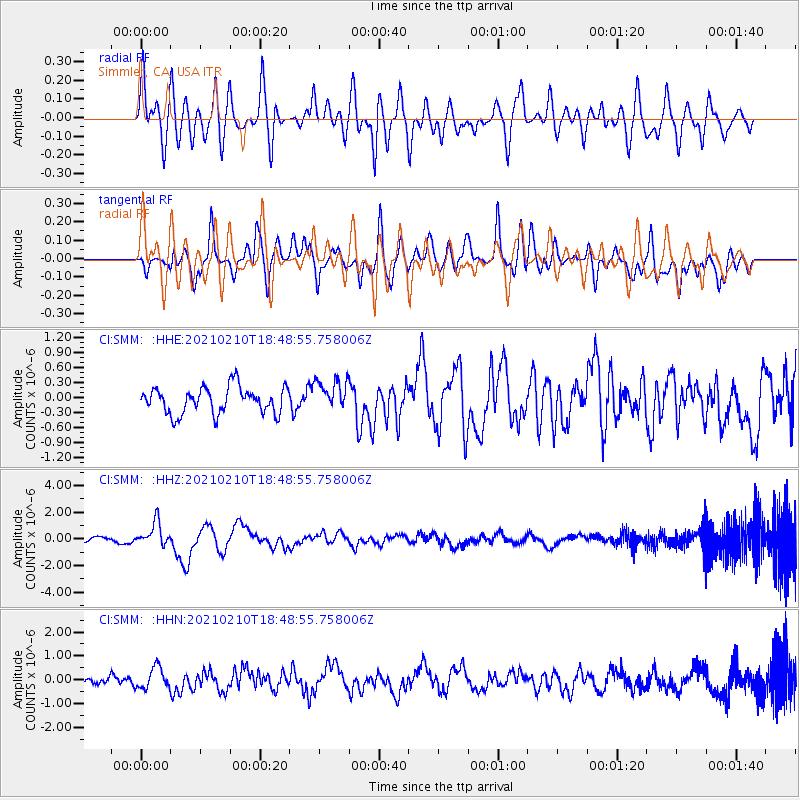
SMM Simmler, CA, USA - Earthquake Result Viewer
*The percent match for this event was below the threshold and hence no stack was calculated.
| Earthquake location: |
Southeast Of Loyalty Islands |
| Earthquake latitude/longitude: |
-22.8/171.1 |
| Earthquake time(UTC): |
2021/02/10 (041) 18:36:41 GMT |
| Earthquake Depth: |
10 km |
| Earthquake Magnitude: |
6.1 mww |
| Earthquake Catalog/Contributor: |
NEIC PDE/us |
|
| Network: |
CI Caltech Regional Seismic Network |
| Station: |
SMM Simmler, CA, USA |
| Lat/Lon: |
35.31 N/120.00 W |
| Elevation: |
599 m |
|
| Distance: |
87.1 deg |
| Az: |
49.796 deg |
| Baz: |
239.536 deg |
| Ray Param: |
$rayparam |
*The percent match for this event was below the threshold and hence was not used in the summary stack. |
|
| Radial Match: |
75.075645 % |
| Radial Bump: |
400 |
| Transverse Match: |
71.03215 % |
| Transverse Bump: |
400 |
| SOD ConfigId: |
23341671 |
| Insert Time: |
2021-02-24 19:46:25.398 +0000 |
| GWidth: |
2.5 |
| Max Bumps: |
400 |
| Tol: |
0.001 |
|
Signal To Noise
| Channel | StoN | STA | LTA |
| CI:SMM: :HHZ:20210210T18:48:55.758006Z | 3.7161052 | 8.642807E-7 | 2.3257702E-7 |
| CI:SMM: :HHN:20210210T18:48:55.758006Z | 2.0753295 | 4.5119256E-7 | 2.1740767E-7 |
| CI:SMM: :HHE:20210210T18:48:55.758006Z | 1.2042342 | 3.1597324E-7 | 2.6238519E-7 |
| Arrivals |
| Ps | |
| PpPs | |
| PsPs/PpSs | |


