You are here: Home > Network List > US - United States National Seismic Network Stations List
> Station HAWA Hanford, Washington, USA > Earthquake Result Viewer
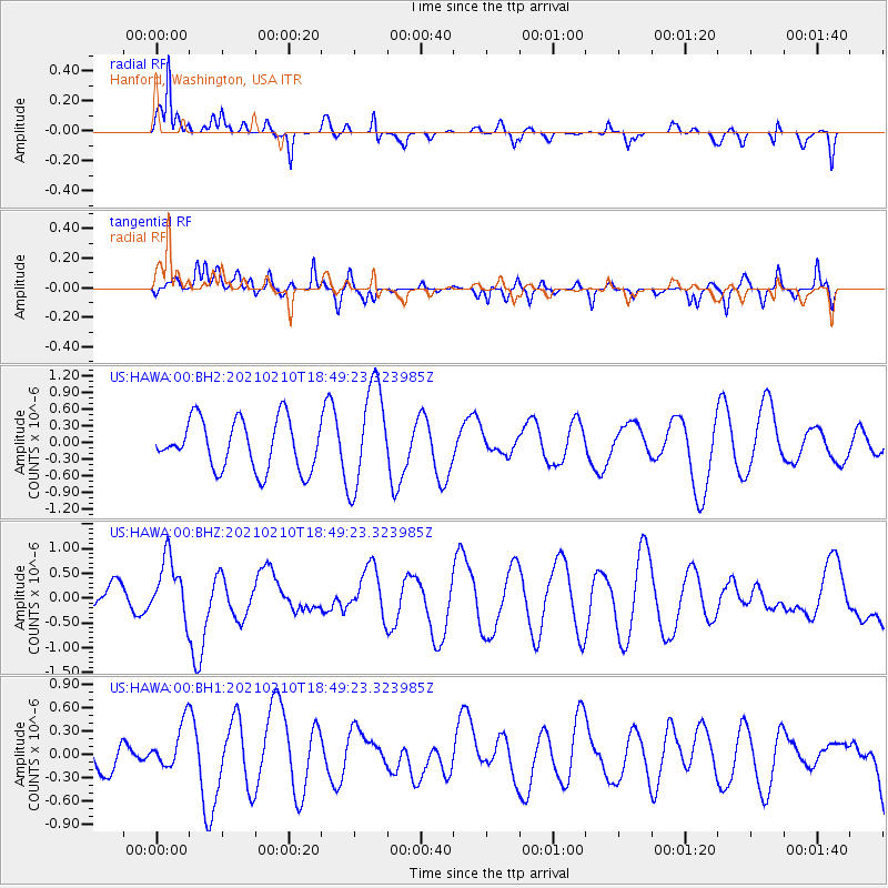
HAWA Hanford, Washington, USA - Earthquake Result Viewer
*The percent match for this event was below the threshold and hence no stack was calculated.
| Earthquake location: |
Southeast Of Loyalty Islands |
| Earthquake latitude/longitude: |
-22.8/171.1 |
| Earthquake time(UTC): |
2021/02/10 (041) 18:36:41 GMT |
| Earthquake Depth: |
10 km |
| Earthquake Magnitude: |
6.1 mww |
| Earthquake Catalog/Contributor: |
NEIC PDE/us |
|
| Network: |
US United States National Seismic Network |
| Station: |
HAWA Hanford, Washington, USA |
| Lat/Lon: |
46.39 N/119.53 W |
| Elevation: |
364 m |
|
| Distance: |
93.0 deg |
| Az: |
40.423 deg |
| Baz: |
239.846 deg |
| Ray Param: |
$rayparam |
*The percent match for this event was below the threshold and hence was not used in the summary stack. |
|
| Radial Match: |
63.72271 % |
| Radial Bump: |
327 |
| Transverse Match: |
38.782352 % |
| Transverse Bump: |
367 |
| SOD ConfigId: |
23341671 |
| Insert Time: |
2021-02-24 19:52:53.364 +0000 |
| GWidth: |
2.5 |
| Max Bumps: |
400 |
| Tol: |
0.001 |
|
Signal To Noise
| Channel | StoN | STA | LTA |
| US:HAWA:00:BHZ:20210210T18:49:23.323985Z | 1.7592418 | 6.0536445E-7 | 3.441053E-7 |
| US:HAWA:00:BH1:20210210T18:49:23.323985Z | 0.9836383 | 3.0117417E-7 | 3.0618386E-7 |
| US:HAWA:00:BH2:20210210T18:49:23.323985Z | 2.0635626 | 9.21751E-7 | 4.4667945E-7 |
| Arrivals |
| Ps | |
| PpPs | |
| PsPs/PpSs | |


