You are here: Home > Network List > US - United States National Seismic Network Stations List
> Station AMTX Amarillo, Texas, USA > Earthquake Result Viewer
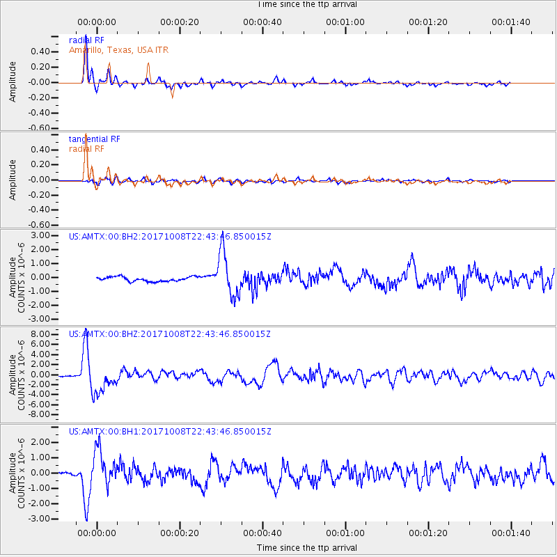
AMTX Amarillo, Texas, USA - Earthquake Result Viewer
*The percent match for this event was below the threshold and hence no stack was calculated.
| Earthquake location: |
Rat Islands, Aleutian Islands |
| Earthquake latitude/longitude: |
52.4/176.8 |
| Earthquake time(UTC): |
2017/10/08 (281) 22:34:33 GMT |
| Earthquake Depth: |
112 km |
| Earthquake Magnitude: |
6.6 mww |
| Earthquake Catalog/Contributor: |
NEIC PDE/us |
|
| Network: |
US United States National Seismic Network |
| Station: |
AMTX Amarillo, Texas, USA |
| Lat/Lon: |
34.53 N/101.41 W |
| Elevation: |
1010 m |
|
| Distance: |
58.8 deg |
| Az: |
72.858 deg |
| Baz: |
314.896 deg |
| Ray Param: |
$rayparam |
*The percent match for this event was below the threshold and hence was not used in the summary stack. |
|
| Radial Match: |
96.05331 % |
| Radial Bump: |
337 |
| Transverse Match: |
72.86956 % |
| Transverse Bump: |
400 |
| SOD ConfigId: |
2364251 |
| Insert Time: |
2017-10-22 22:51:11.030 +0000 |
| GWidth: |
2.5 |
| Max Bumps: |
400 |
| Tol: |
0.001 |
|
Signal To Noise
| Channel | StoN | STA | LTA |
| US:AMTX:00:BHZ:20171008T22:43:46.850015Z | 28.832088 | 2.7027834E-6 | 9.37422E-8 |
| US:AMTX:00:BH1:20171008T22:43:46.850015Z | 12.439936 | 1.1916283E-6 | 9.579055E-8 |
| US:AMTX:00:BH2:20171008T22:43:46.850015Z | 5.6186233 | 9.791877E-7 | 1.7427539E-7 |
| Arrivals |
| Ps | |
| PpPs | |
| PsPs/PpSs | |


