You are here: Home > Network List > II - Global Seismograph Network (GSN - IRIS/IDA) Stations List
> Station XPFO Pinon Flat, California, USA > Earthquake Result Viewer
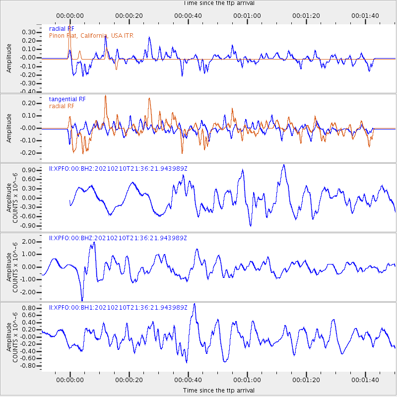
XPFO Pinon Flat, California, USA - Earthquake Result Viewer
*The percent match for this event was below the threshold and hence no stack was calculated.
| Earthquake location: |
Southeast Of Loyalty Islands |
| Earthquake latitude/longitude: |
-23.3/171.6 |
| Earthquake time(UTC): |
2021/02/10 (041) 21:23:59 GMT |
| Earthquake Depth: |
10 km |
| Earthquake Magnitude: |
6.4 mww |
| Earthquake Catalog/Contributor: |
NEIC PDE/us |
|
| Network: |
II Global Seismograph Network (GSN - IRIS/IDA) |
| Station: |
XPFO Pinon Flat, California, USA |
| Lat/Lon: |
33.61 N/116.46 W |
| Elevation: |
1280 m |
|
| Distance: |
88.8 deg |
| Az: |
52.516 deg |
| Baz: |
240.985 deg |
| Ray Param: |
$rayparam |
*The percent match for this event was below the threshold and hence was not used in the summary stack. |
|
| Radial Match: |
78.78425 % |
| Radial Bump: |
400 |
| Transverse Match: |
68.59787 % |
| Transverse Bump: |
400 |
| SOD ConfigId: |
23341671 |
| Insert Time: |
2021-02-24 22:33:33.925 +0000 |
| GWidth: |
2.5 |
| Max Bumps: |
400 |
| Tol: |
0.001 |
|
Signal To Noise
| Channel | StoN | STA | LTA |
| II:XPFO:00:BHZ:20210210T21:36:21.943989Z | 2.8114693 | 9.972186E-7 | 3.546966E-7 |
| II:XPFO:00:BH1:20210210T21:36:21.943989Z | 1.6668997 | 2.3427127E-7 | 1.4054311E-7 |
| II:XPFO:00:BH2:20210210T21:36:21.943989Z | 1.6606289 | 4.777707E-7 | 2.8770467E-7 |
| Arrivals |
| Ps | |
| PpPs | |
| PsPs/PpSs | |


