You are here: Home > Network List > UU - University of Utah Regional Network Stations List
> Station KNB Kanab, UT, USA > Earthquake Result Viewer
KNB Kanab, UT, USA - Earthquake Result Viewer
*The percent match for this event was below the threshold and hence no stack was calculated.
| Earthquake location: |
Southeast Of Loyalty Islands |
| Earthquake latitude/longitude: |
-23.3/171.6 |
| Earthquake time(UTC): |
2021/02/10 (041) 21:23:59 GMT |
| Earthquake Depth: |
10 km |
| Earthquake Magnitude: |
6.4 mww |
| Earthquake Catalog/Contributor: |
NEIC PDE/us |
|
| Network: |
UU University of Utah Regional Network |
| Station: |
KNB Kanab, UT, USA |
| Lat/Lon: |
37.02 N/112.82 W |
| Elevation: |
1715 m |
|
| Distance: |
93.0 deg |
| Az: |
50.909 deg |
| Baz: |
243.101 deg |
| Ray Param: |
$rayparam |
*The percent match for this event was below the threshold and hence was not used in the summary stack. |
|
| Radial Match: |
74.025505 % |
| Radial Bump: |
400 |
| Transverse Match: |
50.77382 % |
| Transverse Bump: |
298 |
| SOD ConfigId: |
23341671 |
| Insert Time: |
2021-02-24 22:38:34.521 +0000 |
| GWidth: |
2.5 |
| Max Bumps: |
400 |
| Tol: |
0.001 |
|
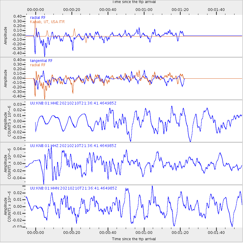
Signal To Noise
| Channel | StoN | STA | LTA |
| UU:KNB:01:HHZ:20210210T21:36:41.464985Z | 2.3173985 | 1.9250127E-8 | 8.306783E-9 |
| UU:KNB:01:HHN:20210210T21:36:41.464985Z | 0.5250233 | 4.0352113E-9 | 7.685776E-9 |
| UU:KNB:01:HHE:20210210T21:36:41.464985Z | 1.2289408 | 1.01092015E-8 | 8.225946E-9 |
| Arrivals |
| Ps | |
| PpPs | |
| PsPs/PpSs | |


