You are here: Home > Network List > CI - Caltech Regional Seismic Network Stations List
> Station MPM Manuel Prospect Mine, California, USA > Earthquake Result Viewer
MPM Manuel Prospect Mine, California, USA - Earthquake Result Viewer
*The percent match for this event was below the threshold and hence no stack was calculated.
| Earthquake location: |
Southeast Of Loyalty Islands |
| Earthquake latitude/longitude: |
-23.5/171.6 |
| Earthquake time(UTC): |
2021/02/10 (041) 21:36:03 GMT |
| Earthquake Depth: |
10 km |
| Earthquake Magnitude: |
5.5 mb |
| Earthquake Catalog/Contributor: |
NEIC PDE/us |
|
| Network: |
CI Caltech Regional Seismic Network |
| Station: |
MPM Manuel Prospect Mine, California, USA |
| Lat/Lon: |
36.06 N/117.49 W |
| Elevation: |
185 m |
|
| Distance: |
89.4 deg |
| Az: |
49.981 deg |
| Baz: |
240.213 deg |
| Ray Param: |
$rayparam |
*The percent match for this event was below the threshold and hence was not used in the summary stack. |
|
| Radial Match: |
60.37531 % |
| Radial Bump: |
287 |
| Transverse Match: |
44.42128 % |
| Transverse Bump: |
323 |
| SOD ConfigId: |
23341671 |
| Insert Time: |
2021-02-24 22:45:17.431 +0000 |
| GWidth: |
2.5 |
| Max Bumps: |
400 |
| Tol: |
0.001 |
|
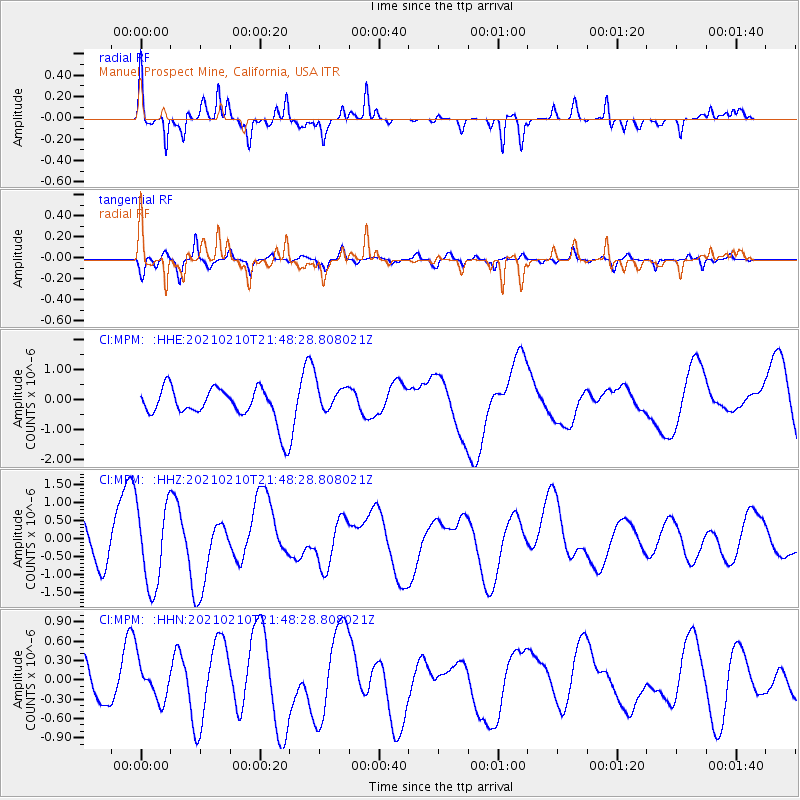
Signal To Noise
| Channel | StoN | STA | LTA |
| CI:MPM: :HHZ:20210210T21:48:28.808021Z | 2.2444758 | 1.1301792E-6 | 5.035381E-7 |
| CI:MPM: :HHN:20210210T21:48:28.808021Z | 0.7205541 | 2.9137E-7 | 4.0436933E-7 |
| CI:MPM: :HHE:20210210T21:48:28.808021Z | 0.93249255 | 5.168717E-7 | 5.542904E-7 |
| Arrivals |
| Ps | |
| PpPs | |
| PsPs/PpSs | |


