You are here: Home > Network List > TA - USArray Transportable Network (new EarthScope stations) Stations List
> Station G16K Koyuk River, AK, USA > Earthquake Result Viewer
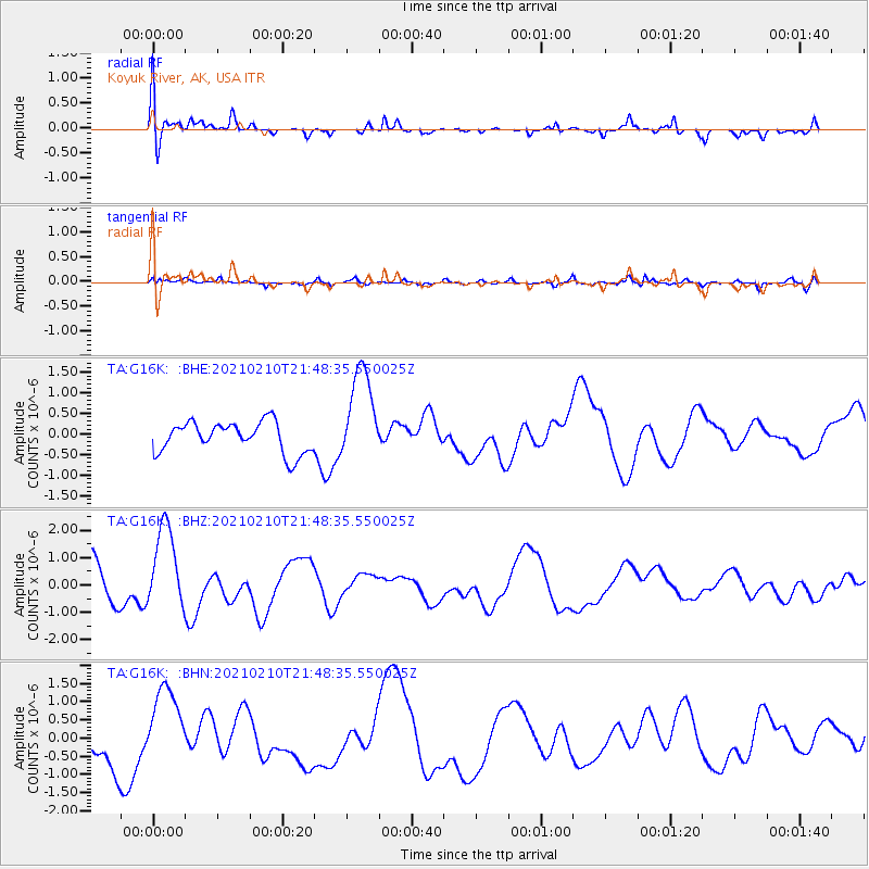
G16K Koyuk River, AK, USA - Earthquake Result Viewer
*The percent match for this event was below the threshold and hence no stack was calculated.
| Earthquake location: |
Southeast Of Loyalty Islands |
| Earthquake latitude/longitude: |
-23.5/171.6 |
| Earthquake time(UTC): |
2021/02/10 (041) 21:36:03 GMT |
| Earthquake Depth: |
10 km |
| Earthquake Magnitude: |
5.5 mb |
| Earthquake Catalog/Contributor: |
NEIC PDE/us |
|
| Network: |
TA USArray Transportable Network (new EarthScope stations) |
| Station: |
G16K Koyuk River, AK, USA |
| Lat/Lon: |
65.39 N/162.35 W |
| Elevation: |
169 m |
|
| Distance: |
90.8 deg |
| Az: |
10.598 deg |
| Baz: |
203.789 deg |
| Ray Param: |
$rayparam |
*The percent match for this event was below the threshold and hence was not used in the summary stack. |
|
| Radial Match: |
42.79086 % |
| Radial Bump: |
400 |
| Transverse Match: |
48.271973 % |
| Transverse Bump: |
400 |
| SOD ConfigId: |
23341671 |
| Insert Time: |
2021-02-24 22:49:40.893 +0000 |
| GWidth: |
2.5 |
| Max Bumps: |
400 |
| Tol: |
0.001 |
|
Signal To Noise
| Channel | StoN | STA | LTA |
| TA:G16K: :BHZ:20210210T21:48:35.550025Z | 2.8668287 | 1.5499985E-6 | 5.4066663E-7 |
| TA:G16K: :BHN:20210210T21:48:35.550025Z | 2.4459348 | 1.1106238E-6 | 4.5406924E-7 |
| TA:G16K: :BHE:20210210T21:48:35.550025Z | 3.1350915 | 1.1609992E-6 | 3.7032387E-7 |
| Arrivals |
| Ps | |
| PpPs | |
| PsPs/PpSs | |


